
Award Winning Tour


Giant's Causeway Tour
Daily Tours to Giant's Causeway
2022 TripAdvisor Travellers Choice Award Winner!
Tour departs daily at 8.30am (returns at approx 6pm)
McComb's Travel offers visitors to Northern Ireland the longest established tour to what is commonly called "The eighth wonder of the world". Travel in one of our award winning coaches along the Causeway Coastal Route for a fun filled day!
Why choose us?
- Ours is THE most comprehensive tour from Belfast, with the most stops
- We have the most modern & comfortble coaches, meaning you enjoy the tour in both safety and comfort
- We're the original Giant's Causeway Tour Company - we created this tour almost 30 years ago!
- Our driver/guides are the most experienced there are - some in our driving seat for more than 20 years!
Enjoy the first stop of the day at Carrickfergus Castle , before travelling onward along the Causeway Coastal Route , stopping off at lovely places like Carnlough and the Caves at Cushendun . We'll move along what has been voted one of the "Top 5 Scenic Drives in the World", where you'll also see towns and villages like Glenarm, Ballygally, Balllycastle, the Glens of Antrim, Cushendall & much more.
We'll stop off at Portaneevy View Point to get some Instagram worthy photos of the iconic Carrick-a-rede Ropebridge - we hope you've a head for heights!
You'll be ready for a rest by now at our lunch venue - The Fullerton Arms in Ballintoy, where there's a tastly pub grub style lunch on offer (payable locally).
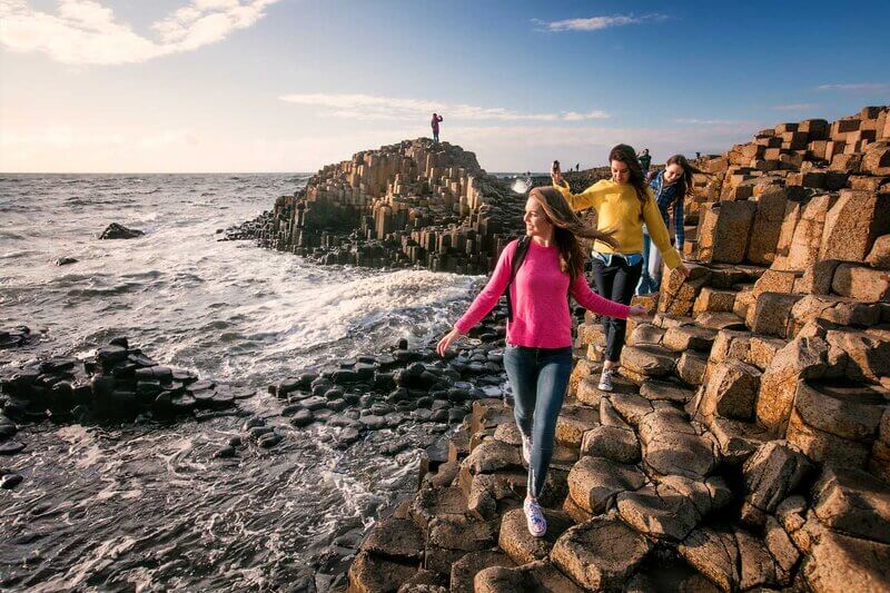
The highlight of the tour is definately a visit to Giant’s Causeway , Irelands only World Heritage Site. Spend some time climbing over the ancient stones, snapping some photos, and enjoying the myths and legends that surround this world famous attraction.
We then re-board our luxury coach, and make our way to along the coast, for a short stop at the breathtaking ancient ruins of Dunluce Castle .
For the Whiskey lovers onboard, we will visit Ireland's Oldest Licenced Whiskey Distillery - Old Bushmills ! There will be time to visit their gift shop, which offers Whiskey only available to buy at Bushmills, or have a tipple or two in the Whiskey Bar.
Our final stop of the day is at the iconic Dark Hedges . Made famous by it's appearance as The Kings Road in Game of Thrones, this picture perfect location ends the tour on a high!
All that then remains to be done is to sit back and relax on the comfortable journey back to Belfast (arrives back at around 6pm depending on the time of year) in one of our award winning luxury coaches.
This really is a must take tour, and with the combination of our luxury coaches, experienced and friendly tour guides, and wonderful attractions, you'd be mad to miss it!
IMPORTANT INFORMATION: There is some walking on what are sometimes uneven surfaces during this tour, and it therefore requires moderate fitness levels. Please come dressed appropriately for not only the season, but also for the activity. While it is always our intention to visit all of the locations listed, if there is an unforeseeing event which means it is not possible to stop at them we may have to adjust the itinerary accordingly. Your driver will always give priority to your safety, and access for the coach without causeing any loss or damage.
Please Also Note: Unfortunately we cannot currently pre-book entry tickets for the visitor centre at Giant's Causeway. You will be able to visit the Giant's Causeway stones Free of Charge (we think that's the best part anyway)!! The National Trust have also made the decision to no longer allow any coaches to visit Carrick-a-rede Ropebridge, therefore we will instead have a Photo Stop at the Portaneevy Viewing Point.
Belfast’s longest running Causeway Tour
Tours available all year
Award Winning Company
- Tour departs at 8.30am from 22 Donegall Road
- Carrickfergus Castle (photo stop)
- Causeway Coastal Route
- Carnlough Harbour
- Cushendun Caves
- Carrick-a-rede Ropebridge (photo stop)
- Pub Grub Lunch Stop
- Giant's Causeway
- Dunluce Castle (Photo stop)
- Bushmills Distillery
- The Dark Hedges
- Tour ends in Belfast City Centre at approx 6pm
or call 028 9031 5333
Excellent value for money and is a must for any new visitor to Belfast !!!
Sunny Day Diner, Leeds
Perfect in every way!
Linda, Florida
Definitely do this trip - it was the highlight of my travel through Dublin and Northern Ireland
LeeLee, Madrid
Like this tour? Then you may also be interested in...

Game of Thrones Tour
By travelling with McComb's you're travelling with the same company as the cast and crew of Game of Thrones!

Airport Transfers
Take the Hassle out of Holidays
- GAME OF THRONES TOUR
THINGS TO DO IN BELFAST
Belfast bus tours, giants causeway tour from belfast.
TOUR HIGHLIGHTS
Transport yourself to UNESCO World Heritage Site the Giant's Causeway - From the moment you leave Belfast onboard our luxury coach your day trip is thoughtfully planned out for you to enjoy an incredible coastal adventure.
- Giant’s Causeway Access
- Visit 2 Stunning Castles
- Travel Full Coastal Route
- Explore Coastal Locations
- Live Expert Commentary
- Carrick-A-Rede Rope Bridge #Viewpoint - Photo Stop
- Visit The Dark Hedges
- Myths Legends Experience
- Travel In Luxury Coaches

Full Description
Seasons itinerary & timings, #summer season - march - october, giants causeway tours.
- Depart Central Belfast 9:00am
- Carrickfergus Castle 20 Minutes - Photo Stop
- Carnlough Harbour 20 Minutes
- Cushendun Caves 25 Minutes
- The Dark Hedges 90 Minutes - Lunch & Explore
- Carrick a Rede Rope Bridge Viewpoint - Photo Stop
- Giant's Causeway Stones Access Access Included 90 Mins Approx
- Dunluce Castle Photo Opportunity
- Return Belfast City Approx 6 - 6:30pm *Timings At Locations May Vary
#WINTER SEASON - NOVEMBER - FEB
- The Dark Hedges 90 Minutes
- Giant's Causeway Stones Access Included 2 hours approx
- Carnlough Harbour 15 Minutes
- Carrickfergus Castle 20 Minutes
- Return Belfast City Approx 5:15 - 5:30pm *Timings At Locations May Vary
MEETING POINT & DROP OFF
- Arrive 8:45am - Depart 9:00am
- 10 Great Victoria Street - Belfast --- Next To Sub-Way Store ---
- Mobile E - Tickets Accepted.
THINGS TO BRING
If you decide to get off at any of our designated stops there can be times where you will need to walk to specific locations. Please come dressed appropriately for the season but keep in mind, the weather on the Coastal route can be cold at any time of the year.
- Covid Mask - Optional
- Money For Lunch - Refreshments
- Packed lunch recommended
- Comfortable shoes
- Suitable clothing
INCLUSIONS - HIGHLIGHTS
- Giants Causeway Stones Access
- Walk Across Rope bridge (Closed Covid - Until 2024)
- Luxury Transport Roundtrip
- Friendly Live Guide Host
- Lunch - Snacks - Drinks.
COVID PRECAUTIONS
Be rest assured you will be traveling in super clean coaches - each nite every coach is fully disinfected in order to stop the spread of Covid. We work to all government guidelines in order to fully protect all visitors and staff. For more information please see the full company mission statement here
CANCELLATION POLICY
- 24 Hours Notice Free Cancellation
- Less Than 24 hours Prior NO SHOW - 100% Forfeited.
- Reshedule Free 24+ Hours Message Us --- Call Us
UEST REVIEWS

- Giant's Causeway Tour from Belfast
- Tours of Ireland
- Day Tours from Belfast
11 other people are looking at this tour
Why choose this tour?
See all of Northern Ireland's highlights in one day
Northern Ireland's most luxurious fleet
Northern Ireland's most experienced guides
Northern Ireland's highest rated operator
Free 4G unlimited WiFi & USB ports
Risk Free - 100% Refund up to 24 hours before tour
Pick-up Points
- 09:45am - Europa Hotel
Depart Belfast
Causeway coast road trip, dark hedges, giants causeway (unesco world heritage site), dunluce castle (house of greyjoy), arrive back in belfast, alternative routes.
If this popular route is sold out you may wish to consider one of these...
Giant's Causeway Tour from Dublin
(small group) giant's causeway tour from dublin, additional info.

Free Cancellation
- For a full refund, you must cancel at least 24 hours before the tour's start time.
- If you cancel less than 24 hours before the tour's start time, the amount you paid will not be refunded.
- Any changes made less than 24 hours before the tour's start time will not be accepted.
- Cut-off times are based on the local time in Ireland.
Why Book Direct?
You help a local business to recover from the pandemic
You help to maximise the employment of our amazing guides
You enjoy a Best Price Guarantee
You enjoy the Best Cancellation Policy in Ireland
You enjoy Guaranteed Access where tours are overbooked
You contribute to our investment in carbon offset
We say Go Raibh Mile Maith Agat (1000 thanks!)
Paddywagon Tours
You might also like..., cancellation policy, free cancellation.
- Giants Causeway tour including Game of Thrones Film Locations

- City Sightseeing tour
- Timetables & Tour duration
- Tour prices
- Hop on Hop off route map
- Belfast Hop on Hop off bus stops
- How to book & join the tour
- Highlights of the tour
- Access for those with limited mobility
- Multilingual commentary
- Cupones de Regalo del Autobus Turistico de Belfast
- Visitor Information
- Useful Information
- Things to do in Belfast
- Left Luggage
- Accreditations & Awards
- Tour guide supply
- Team building exercises
- Attractions
- Titanic Belfast Experience
- HMS Caroline
- St Georges Market
- Belfast City Hall
- St Annes Cathedral
- Stormont Parliament Buildings
- Cathedral Quarter
- CS Lewis Square
- Culturlann McAdam O'Fiaich
- Grand Opera House
- Belfast Castle
- MAC Belfast
- Titanic Dock & Pumphouse
- Documentation
- Privacy policy
- Terms and conditions
- Complaints procedure
- Corporate responsibility
- Website disclaimer
- Giants Causeway Tour
- Combo tours
- Giants Causeway & Belfast City Tour
- Titanic Belfast & Belfast City Tour
- Giants Causeway, Titanic Belfast & Belfast City Tour
- St Anne's Cathedral & Belfast City Tour
- Line of Duty & Belfast City Tour
- Dublin & Belfast City Sightseeing Tour
- HMS Caroline & Belfast City Tour
- Derry & Belfast City Sightseeing Tour
- Shore Excursions
- Giants Causeway & Belfast City Sightseeing Tour from Cruise Ships
- Taylor Swift Concert
- Pink Concert
- Coldplay Concert
- Giants Causeway Tour from Belfast including Game of Thrones Film Locations
- Tours from Dublin
- Giants Causeway Tour from Dublin
- Cliffs of Moher Tour from Dublin
- Kilkenny & Wicklow Tour from Dublin
- Game of Thrones Tour from Dublin
- Ring of Kerry & Dingle Peninsula Tour
- Cliffs of Moher Galway Aran Islands
- Tayto Theme Park Day Trip
- Dublin Zoo Day Trip
- Kildare Village Shopping Trip
- Walking tours
- Belfast Free Walking tour
- Belfast Political tour
- Giants Causeway cliff path tour
- Dublin Free Walking tour
- Falls Road Mural tour
- Belfast Troubled History tour
- Tour de los Murales de Belfast
- Other tours
- Belfast Black Cab tour
- Line of Duty tour
- Bespoke group tours
- Coach holidays
- Kerry Highlights Tour
- Galway Highlights Tour
- Mayo Highlights Tour
- Mayo Highlights Tour including Country Music Festival
- Blackpool Highlights Tour
- Airport Transfers
- Bespoke Group Tours
- Corporate Hire
- Cross Community
- Executive Car Hire
- Hens and Stags
- Promotional Hire
- School Trips
- Shopping Trips
- Sporting Events
Giants Causeway Tour from Belfast

Giants Causeway Day Tour

Luxury Transport on Causeway Tour (Small Group Tour)

We adhere to all applicable Covid regulations as defined by government. We cannot guarantee that all sites are operational; however, we will do our best to make your experience the very best we can.
Odyssey Coach Tours offer a variety of tours departing from Belfast to various destinations of interest throughout Northern Ireland.
Click on any of our Tours to read more and Book Online
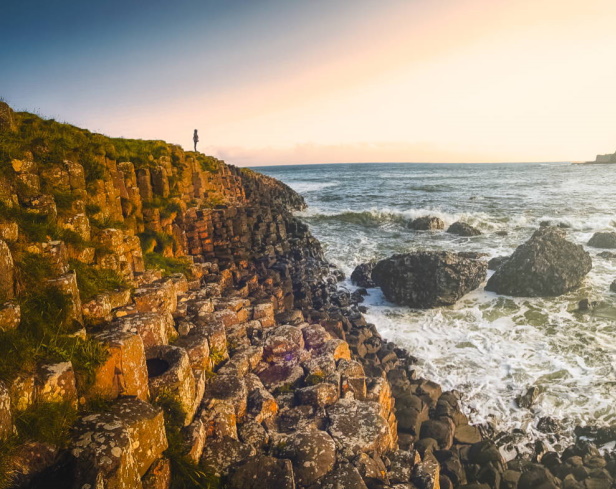
Giants Causeway Day Tour (Small Group)
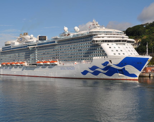
Shore Excursion: Giants Causeway Tour From Belfast Port
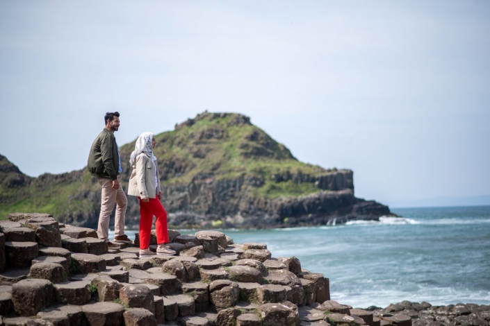
Shore Excursion: Giants Causeway Tour (Small Group)
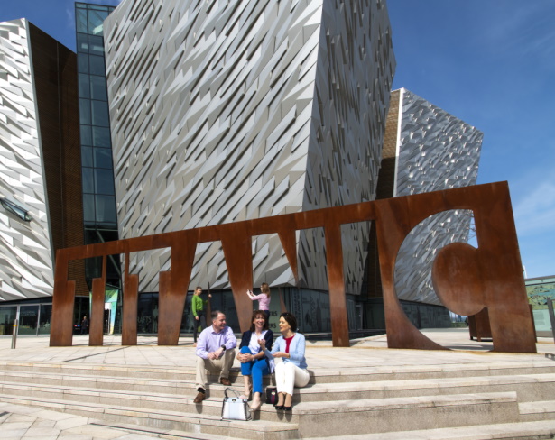
Shore Excursion: Giants Causeway and Titanic Centre
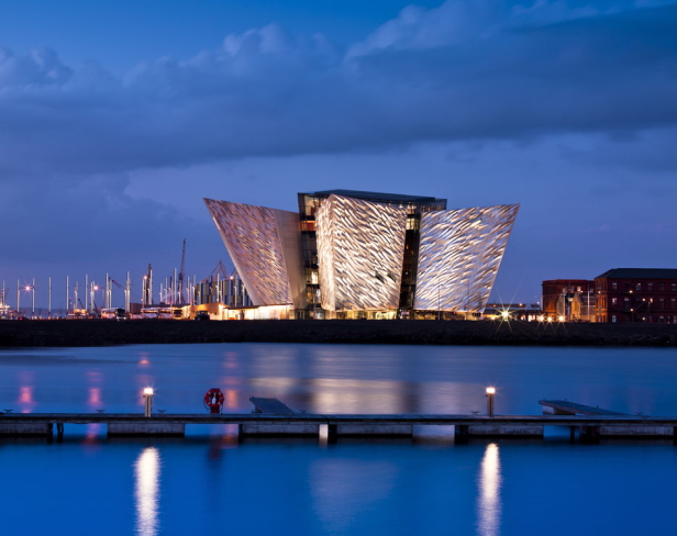
Shore Excursion: Giants Causeway and Titanic Centre (Small Group)

Follow us on Facebook

- Giants Causeway Bus Tour From Belfast April 28, 2022 - 6:24 am
- New Giants Causeway Bus Tour April 28, 2022 - 12:26 am
- Privacy Overview
- Strictly Necessary Cookies
- Privacy Statement & Cookie Policy
This website uses cookies so that we can provide you with the best user experience possible. Cookie information is stored in your browser and performs functions such as recognising you when you return to our website and helping our team to understand which sections of the website you find most interesting and useful.
Strictly Necessary Cookie should be enabled at all times so that we can save your preferences for cookie settings.
If you disable this cookie, we will not be able to save your preferences. This means that every time you visit this website you will need to enable or disable cookies again.
More information about our Privacy Statement & Cookie Policy

The Giants Causeway & North Antrim Coast 9-Hour Tour
Step into a world of history, breathtaking landscapes, and iconic landmarks with our 9-hour tour that takes you on an unforgettable journey through Northern Ireland's treasures. From the mystique of ancient castles to the unique rock formations of the Giant's Causeway, you'll be captivated at every turn.
Tour Highlights
Carrickfergus Castle
Scenic Costal Drive Glens Of Antrim
Ballygally Castle
Glenarm Castle
Carrick-A-Reed Rope Bridge
Giant's Causeway
Bushmills Distillery
Dunluce Castle
The Dark Hedges
1. Carrickfergus Castle - Our journey begins with a visit to the magnificent Carrickfergus Castle, one of Ireland's best-preserved castles, steeped in history. Take a leisurely walk, capturing stunning views and memorable photographs.
2. Scenic Coastal Drive - Travelling along the coast, we pass through picturesque towns and villages, offering ample opportunities for photo stops. Marvel at the stunning landscapes and coastal vistas along the Giant's Causeway coastal road and the Glens Of Antrim.
3. Ballygally Castle - En route, catch a glimpse of Ballygally Castle, reported to be the oldest occupied building in Ireland. Learn about the castle's intriguing history and the famous ghost stories associated with it.
4. Glenarm Village and Castle Walls - Discover the enchanting Glenarm Village and explore the historic Glenarm Castle walls. This stunning castle, dating back to the 1750s, is steeped in history and culture.
5. Carnlough Harbour - Immerse yourself in the beauty of Carnlough Harbour, a picturesque fishing village with a rich history. Featured in Game of Thrones as Braavos, this sleepy harbour offers a glimpse into the world of the hit HBO series.
6. Carrick-A-Rede Rope Bridge Viewing Point - Enjoy a panoramic view of the world-famous Carrick-A-Rede Rope Bridge, suspended almost 100m above the Atlantic Ocean. Please note that bridge crossing requires advance ticket purchase and additional time allocation would need to be purchaced in advance. The crossing of the bridge takes aprox 120 minutes with a 1km walk to the bridge from the car park and 240 stairs down and a very steep set of stairs at the end and usually a long wait in line before crossing and then repeat the journey back.(NOTE our set tour does not do the crossing)
7. Ballintoy Harbour - Visit the charming Ballintoy Harbour, known for its sandy beach, rugged rocks, and lime caves. Recognised as the home of Theon and Yara Greyjoy in Game of Thrones, this location offers stunning coastal views.
8. Dunseverick Castle Ruins - Step back in time as you explore the historic ruins of Dunseverick Castle, perched on the Causeway coastline. Absorb the atmosphere of this ancient castle and its connection to the Dalriada Gaelic kingdom.
9. The Giant's Causeway - Witness Northern Ireland's only UNESCO World Heritage Site and the eighth wonder of the world - The Giant's Causeway. Marvel at the unique hexagonal rock formations resulting from volcanic activity. Note that an advance ticket purchase is required for entry to the visitors' centre only and the stones are free of charge to visit but car parking is charged at £10.00 (paid locally) (NOTE our set tour doesn't include the visitors centre)
10. Causeway Hotel - Savour a delicious lunch at the historic Causeway Hotel, known for its character and delightful culinary offerings. Indulge in freshly baked scones, hot meals, and beverages, including their renowned Baileys hot chocolate and Bailey’s coffee. (not included in price)
11. Dunluce Castle Viewing Point - Enjoy a scenic drive through Bushmills town, culminating in a visit to the Dunluce Castle viewing point. Admire the impressive castle ruins perched atop the North Antrim coast. Additional time and advance ticket purchases may be required to enter the ruins and additional time allocation would need to be purchaced in advance.(NOTE our set tour does not include entering the castle)
12. Bushmills Distillery - Experience the world's oldest licensed distillery, Bushmills Distillery, which has been crafting whiskey since 1608. Explore the distillery, browse the shop, and consider indulging in a whiskey-tasting experience. Please note that advance ticket purchases may be required for the distillery tour and additional time allocation would need to be purchaced in advance for the tour. The Distillery Tour takes aprox 90 minutes to complete. (NOTE our set tour does not include the tour but does allow time to do a tasting at your own expense)
13. Dark Hedges - Conclude your tour at the famous Dark Hedges tree tunnel, a captivating avenue of Beech trees dating back over 300 years. Known for its appearance in Game of Thrones, this natural wonder provides a memorable ending to our journey before we head back home via the motorway.
Please note that the tour duration is approximately 9 hours from pickup to drop-off, considering factors such as weather, queuing, and mealtimes. However, we strive to make the most of our time together and provide a fulfilling experience. The tour can be customised to suit your preferences, and we are open to incorporating additional attractions upon request. This tour would normally have enough time to include either the Rope Bridge crossing or the Distillery tour without purchasing extra time.
How long is the tour?
The tour is approximately 9 hours from pickup to drop off.
Are tickets required in advance?
Yes, for attractions like the Carrick-A-Reed Rope Bridge, Dunluce Castle, and Bushmills Distillery & we can help book these for you.
Can the tour be adjusted?
Absolutely! We're flexible to accommodate your preferences and interests.
Is the tour accessible for those with mobility issues?
Yes BUT only to certain sites, we can provide wheelchair-accessible vehicles on request and there is as much, or as little walking as you wish. Also during peak hours, a bus runs to and from the Giant's Causeway stones at an additional cost of £1. The Rope Bridge walk has 400 gradient stairs and is over 2km walk to and from the bridge and this can be replaced with the view point only if you wish.
Tailored Experiences: If there's something not on our list that you're keen on, or if you wish to adjust the itinerary, please let us know. We also offer tailored experiences, including specialized tours across Northern Ireland.
Embark on Your Adventure Today!
Phone: +44(0)7732961974
Email: [email protected]
What sapp: +447802902296
- to shop faster,
- be up to date on an orders status,
- keep track of the orders you have previously made.
Click on the "Continue" button, then complete the details on the account page and we will contact you to finalise the process.

Check out the attractions
Did you know?

What our customers say!

Giants causeway tours
Welcome to the giants causeway day tour.


Guide To Visiting Northern Ireland’s Spectacular Giant’s Causeway + Tips
At first glance, you might think Giant’s Causeway was the product of thousands of sculptors chiseling away.
But it’s not. It’s a natural phenomenon, and one of the UK’s most celebrated tourist sites.
This amazing UNESCO site is the result of volcanic activity. It’s made of roughly 40,000 interlocking hexagonal columns made of basalt.
To top that off, the causeway is set on a promontory where steep cliffs and crashing waves make a pretty sight.
You can even clamor about on the rocks, although one does wonder a bit how much longer this will be allowed.
- Giant’s Causeway itself is free to visit.
- However, the visitor’s center is 15 euros.
- You’ll also have to pay for parking, although you can park for free down the hill and walk up.
- You can opt for the blue trail (easy to moderate) or the red trail (more challenging hiking).
- There’s also a transit bus that goes up and down the blue trail for £ 1 each way.
- There are free public restrooms onsite.
Legend Of Giant’s Causeway
As with most sites in Ireland, Giant’s Causeway comes complete with a tall tale from Irish mythology.
The story involves an Irish giant named Finn McCool. Naturally, many tidbits seem to vary depending on who tells the tale.
Anyway, one day, Finn saw a Scottish giant, Benandonner, waving to him from across the Irish Sea. But the Irish giant misinterpreted the friendly gesture, thinking that the Scot had challenged him to a duel.
He built a causeway from Ireland to Scotland so the pair could meet and kick the bajaysus out of each other.
But Finn was dead tired from his efforts. He promptly fell asleep at home in his giant bed.
Finn’s quick witted wife, anticipating a visit from Benandonner, dressed him up like a baby, bonnet and all.
When Benandonner came to call with thunderous footsteps, the wife told him to shush or he’d wake the “baby.”
Benandonner took one look at the giant baby. He decided on the spot that if Finn’s baby was that big, Finn must really be the giant of all giants.
So, Benandonner legged it back home to Scotland. Along the way, he destroyed the causeway so Finn couldn’t follow him.
Fun Fact : Another version of the tale is the Finn built the causeway to reach his girlfriend on the island of Staff.

Guide To Giant’s Causeway
The geology bit.
About 60 million years ago, there was an immense amount of volcanic activity and a lava plateau formed.
Eventually, it began to cool and fracture, much like dried mud.
When lava cools evenly, which it did here, it creates the distinctive hexagonal columns that the site is famous for.
The columns vary in size, with the tallest reaching about 39 feet. Others just make nice stepping stones.
There are four trails around Giant’s Causeway.
But the red and blue trails are the most accessible, popular, and well-marked. I did both of them, which I highly recommend doing if you have the time.
To do this, you start on the Red Trail over the tunnel. You can enjoy the clifftop views, then descend via the Shepherd’s Steps to the Blue Trail, which will take you down to the causeway.
This gives you both the high and low perspectives of the extraordinary landscape.
Here’s a quick run down of the trails:

Blue Trail :
The Blue Trail is the easiest and most accessible route and the most visually appealing. To access it, just head through the tunnel.
The trail is paved and relatively flat, making it suitable for visitors of all ages and abilities, including families with strollers and those with limited mobility.
Along the way, you’ll also see formations like the “Wishing Chair,” a naturally formed seat among the columns, and the “Organ Pipes,” a series of tall, pillar-like columns resembling a giant organ.

The blue trail directly leads to the iconic basalt columns on the Grand Causeway, which are the main attraction.
So it’s a natural choice for first-time visitors. A blue bus runs along he footpath and there are some seats to stop and gawk at the views.
You can walk on and explore the rocks, some of which look like giant pencils. Just be careful not to turn an ankle!
Duration : About 30-45 minutes out and back. But you may want to plop down on a rock (with the rest of humanity) and just take in the setting.
Red Trail :
The Red Trail offers stunning bird’s eye views from the 300 foot clifftops of the rugged coastline.
Stay away from the cliff edge! It’s unfenced and the ground can be slippery.
It’s slightly more challenging than the Blue Trail with a dirt path and some uneven terrain. But still manageable for most visitors.
Duration: About 1-1.5 hours
Yellow Trail :
The Yellow Trail follows the Shepherd’s Path, starting at the Visitor Centre and ascending the cliffs.
It offers fantastic views of the coastline and the Giant’s Causeway from above. The trail involves some steep steps and a bit more exertion than the Blue Trail.

You can access the Yellow Trail directly from the Visitor Centre, where it begins by following the same route as the Blue Trail before diverging and climbing the steps known as the Shepherd’s Steps to the clifftop.
Duration: About 45 minutes to 1 hour
Green Trail :
The Green Trail is a longer route that offers a full circuit, starting at the Visitor Centre and following the Red Trail along the clifftop.
It then loops back inland, offering a more varied landscape that includes fields and views of Runkerry House.
This trail is relatively easy, with some moderate sections. You access it from the same starting point as the Red Trail at the Visitor Centre.
Duration: About 1.5 to 2 hours

Visitor Center
The Visitor’s Center is an interesting modern building. It was designed to reflect the natural architecture of the causeway.
You’ll have to pay a fee to enter, even if you’re only using the restaurant or gift shop.
Inside, there are exhibits on the causeway and the geology of the area.

Tips & FAQ For Giant’s Causeway
Where is giant’s causeway.
Giant’s Causeway is located on the north coast of Northern Ireland, in County Antrim.
It’s about 3 miles northeast of the town of Bushmills and approximately 60 miles north of Belfast.

How To Get There
If you’re driving, it’ll be 1.5 to 2 hours from Belfast. From Dublin, it’s 3.5 to 4 hours.
You can also take a combination of trains and buses, but it will take much longer.
There are guided day tours from Dublin that include the Giant’s Causeway as part of a full-day itinerary.
These are loooong, typically lasting 12-13 hours. Buses depart from Parnell Square N in north Dublin.
You can also book a day tour from Belfast . Another popular option is a combined tour of Titanic Belfast and Giant’s Causeway.

Giant’s Causeway is free.
But the Visitor’s Center is 16.50 euros or 41.25 euros for a family.
Your ticket includes an audio guide to the blue and red trails.
When To Visit Giants Causeway
The site is open year round, though you’ll naturally get worse weather in the winter.

I was incredibly lucky to have a sunny day. But you should prepare for rain and high winds.
In terms of time of day, I would try to plan for early morning or late afternoon if that works for your schedule.
In the afternoon, you’ll get the “golden hour” before sunset. At this time of day, the columns are bathed in a golden glow, making for stunning photographs.
Sunset is also a splendid time to visit, as the sun sets into the Irish Sea.
If you’re concerned about being able to scamper on the stones, you might check the tidal forecast. Low tide is best for this.

What Other Attractions Are Nearby?
If you are out with the car for the day, there are a few other attractions you can visit on your gadabout along the coastal route.
Dunluce Castle is a dramatic cliffside ruin, which inspired the Greyjoy Castle in Game of Thrones . The castle, with some CGI magic, appears in season 2.
It was home to a colorful cast of warlords. The top kingpin was Sorely Boy, leader of the MacDonnell clan.
The Carrick-a-Rede Rope Bridge is a must for dare devils, and just 7 miles away.
It spans 66 feet and connects the mainland to the small island of Carrick-a-Rede (just a large rock really). On clear days, you can see Scotland from the island.

The Dark Hedges is an avenue of beech trees planted in the 18th century. It’s famous as the Kingsroad in Game of Thrones .
It’s a little worse for wear, as some of the trees have died back over time, lessening the atmospheric effect. Still if you are a rabid GOT-er, it’s a must visit.
I hope you’ve enjoyed my guide to Giant’s Causeway. You may find these other UK travel guides useful:
- 1 day in Belfast itinerary
- 3 days in London itinerary
- 5 days in London itinerary
- Best day trips from London
Pin it for later.

Last Updated on August 19, 2024 by Leslie Livingston
Discovering Ireland: 10 Must-Visit Places For Every Traveler's Bucket List
Wondering the best places to visit in Ireland? The Emerald Isle, with its green hills, ancient castles, and vibrant culture, is a must-visit.
Camilla Amadi • Aug 17, 2024
Updated Aug 19, 2024
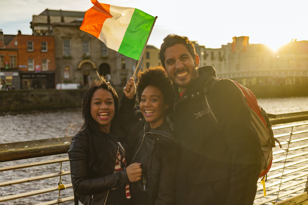
Wondering the best places to visit in Ireland? The Emerald Isle , with its rolling green hills, ancient castles, and vibrant culture, beckons travelers from around the world. From the bustling streets of Dublin to the rugged coastal cliffs of the Wild Atlantic Way, each destination in Ireland offers a unique charm, ripe for exploration.
Imagine wandering through medieval castles, sipping a pint of Guinness in a cozy pub, or gazing out overdramatic sea cliffs . Perhaps you’re drawn to the rich literary history, traditional Irish music sessions, or the warm hospitality of the locals.
This guide will take you on a virtual journey through Ireland’s most captivating places. We’ll unveil hidden gems and iconic experiences that await in each destination. Whether you’re a history enthusiast, a nature lover , or a culture seeker, we’ll help you craft the perfect Irish itinerary.
So, grab your virtual passport and let’s explore the best places to visit in Ireland!
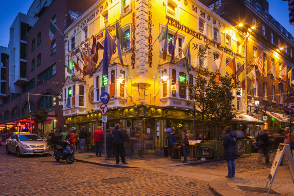
Best Time to Visit: Late spring (April to May) or early fall (September to October)
Transportation Options: Dublin Airport; DART train, Luas tram, or buses within the city.
Ireland’s capital is known for its literary heritage and vibrant culture. James Joyce’s “ Ulysses “. Serving as its filming location, “ Once ” (2007) captures the city’s musical spirit.
Things to Do: Visit Trinity College and the Book of Kells . As well, explore the Guinness Storehouse, wander through St. Stephen’s Green, and experience the nightlife in Temple Bar. Where to Eat: Enjoy traditional Irish fare at The Brazen Head (Ireland’s oldest pub), sample modern Irish cuisine at Chapter One, and indulge in seafood at SOLE Seafood & Grill. Where to Stay: Consider luxury hotels like The Shelbourne or boutique hotels like The Dean.
Best Time to Visit: Summer (June to August) for festivals or shoulder season (April-May, September-October) for fewer crowds
Transportation Options: Bus and train connections from major cities; walkable city center.
Glaway boasts a vibrant arts scene, traditional Irish music, and the annual Galway International Arts Festival. Fun Fact: Galway is also known as “The City of Tribes” due to the 14 merchant families who dominated the city in the Middle Ages.
Things to Do: Stroll through the colorful streets of the Latin Quarter, enjoy traditional music sessions in local pubs, explore the Galway City Museum, and take a day trip to the Cliffs of Moher. Where to Eat: Try seafood at Hooked, enjoy farm-to-table cuisine at Loam, and sample local specialties at the Galway Market. Where to Stay: Consider boutique hotels like The G Hotel or charming B&Bs like The Stop B&B.
Killarney And The Ring Of Kerry
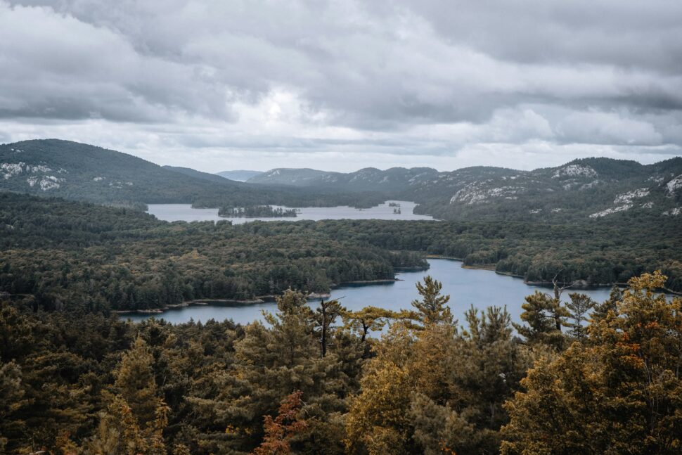
Transportation Options: Bus tours are popular for the Ring of Kerry; Killarney is accessible by train and bus.
It has stunning landscapes including lakes, mountains, coastal views and Killarney National Park. Fun Fact: The Ring of Kerry is exactly 179 km (111 miles) long.
Things to Do: Drive the scenic Ring of Kerry, explore Killarney National Park , visit Ross Castle, and take a jaunting car ride through the Gap of Dunloe.
Where to Eat: Dine at Bricín Restaurant for traditional boxty, enjoy fine dining at The Park Restaurant, and try pub fare at Murphy’s Bar. Where to Stay: Consider lakeside hotels like The Europe Hotel & Resort or historic properties like Cahernane House Hotel.
Cliffs Of Moher
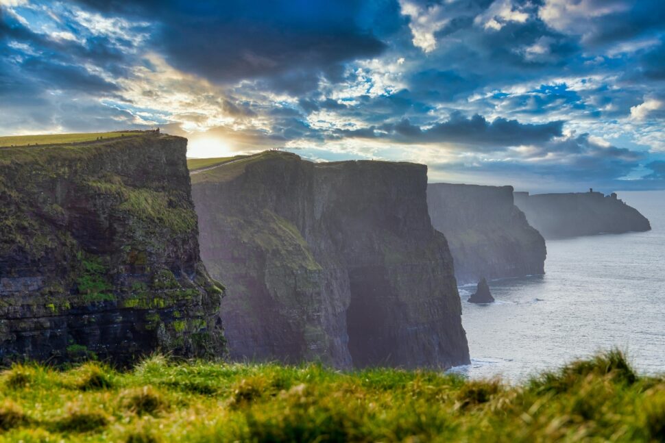
Best Time to Visit: Summer (June to August) for best weather, or shoulder season (April-May, September-October) for fewer crowds
Transportation Options: Accessible by bus tours from Galway and Limerick; private car recommended for flexibility.
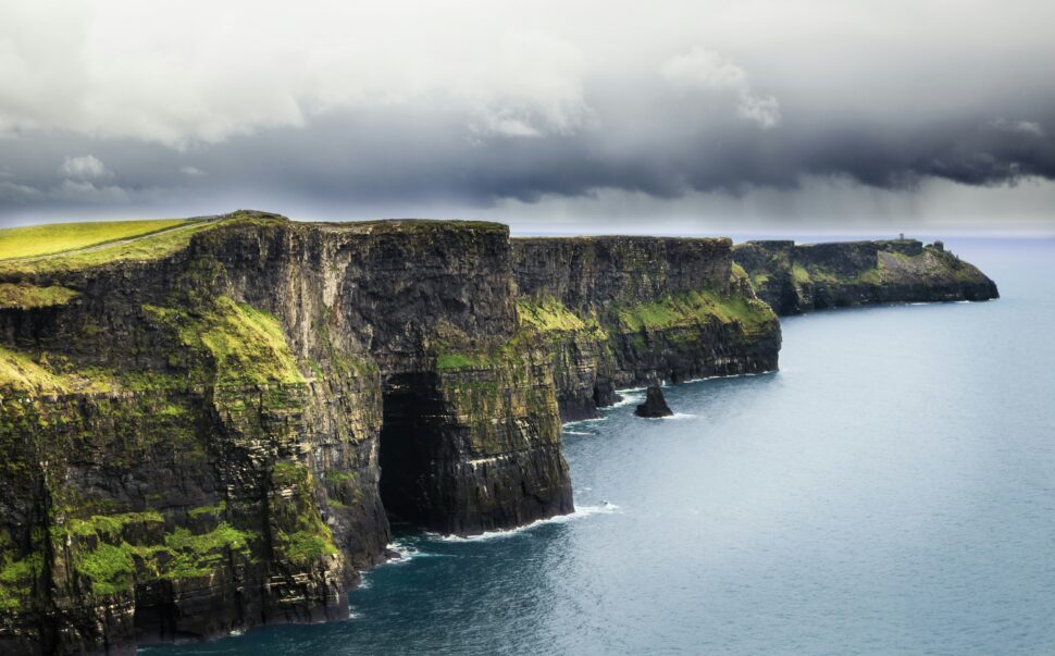
Dramatic sea cliffs rising 214 meters (702 feet) above the Atlantic Ocean. Fun Fact: The cliffs have featured in several films, including “Harry Potter and the Half-Blood Prince”.
Things to Do: Walk along the cliff edge for stunning views, visit the interpretive center, take a boat tour to see the cliffs from the sea, and explore nearby Doolin village. Where to Eat: Enjoy seafood at Vaughan’s Anchor Inn in Liscannor, try local fare at McGann’s Pub in Doolin, and sample homemade treats at the Cliffs of Moher Visitor Centre. Where to Stay: Consider nearby accommodations like Hotel Doolin or Sheedy’s Country House Hotel in Lisdoonvarna.
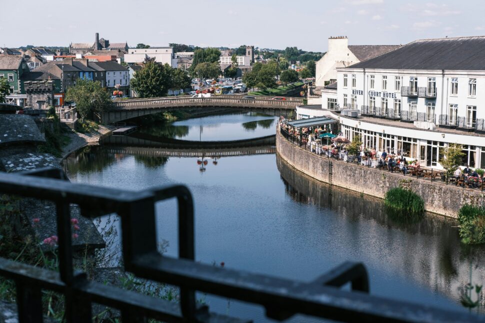
Best Time to Visit: Spring (March to May) or fall (September to November)
Transportation Options: Regular train and bus services from Dublin and other major cities.
It consists of a lot of medieval architecture, including Kilkenny Castle and St. Canice’s Cathedral. Fun Fact: Kilkenny is known as the “Marble City” due to the black polished limestone (“Kilkenny marble”) quarried there.
Things to Do: Explore Kilkenny Castle, wander through the Medieval Mile, visit St. Canice’s Cathedral, and tour the Smithwick’s Experience. Where to Eat: Dine at Michelin-starred Campagne, enjoy pub grub at Kyteler’s Inn, and try local specialties at Zuni Restaurant. Where to Stay: Consider castle hotels like Mount Juliet Estate or boutique options like Butler House.
Dingle Peninsula
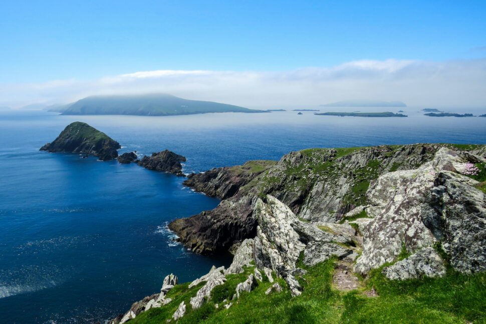
Best Time to Visit: Summer (June to August) for best weather, or shoulder season (April-May, September-October) for fewer crowds.
Transportation Options : Bus services available; car rental recommended for exploring.
It is a rugged coastline, sandy beaches, and archaeological sites; strong Irish language tradition. Fun Fact: The Dingle Peninsula is the westernmost point of Ireland and Europe.
Things to Do: Drive the scenic Slea Head Drive, take a boat trip to see Fungie the Dolphin, explore ancient ruins and beehive huts, and enjoy traditional music in Dingle town. Where to Eat: Sample seafood at Out of the Blue, enjoy farm-to-table cuisine at The Global Village, and try ice cream at Murphy’s. Where to Stay: Consider seaside accommodations like Pax Guest House or centrally located options like Dingle Benners Hotel.
Giant’s Causeway, Northern Ireland
Transportation Options: Bus tours from Belfast; car rental for independent travel.
It is a unique hexagonal basalt columns formed by volcanic activity. Fun Fact: According to legend, the causeway was built by the giant Finn MacCool to fight a Scottish giant.
Things to Do: Explore the unique hexagonal basalt columns, visit the Giant’s Causeway Visitor Centre, hike along the coastal trails, and take in the views from the Causeway Coastal Route. Where to Eat: Enjoy seafood at The Nook, dine with a view at The Bushmills Inn Restaurant, and try local produce at Tartine Restaurant. Where to Stay: Consider nearby options like The Bushmills Inn or Bayview Hotel Portballintrae.
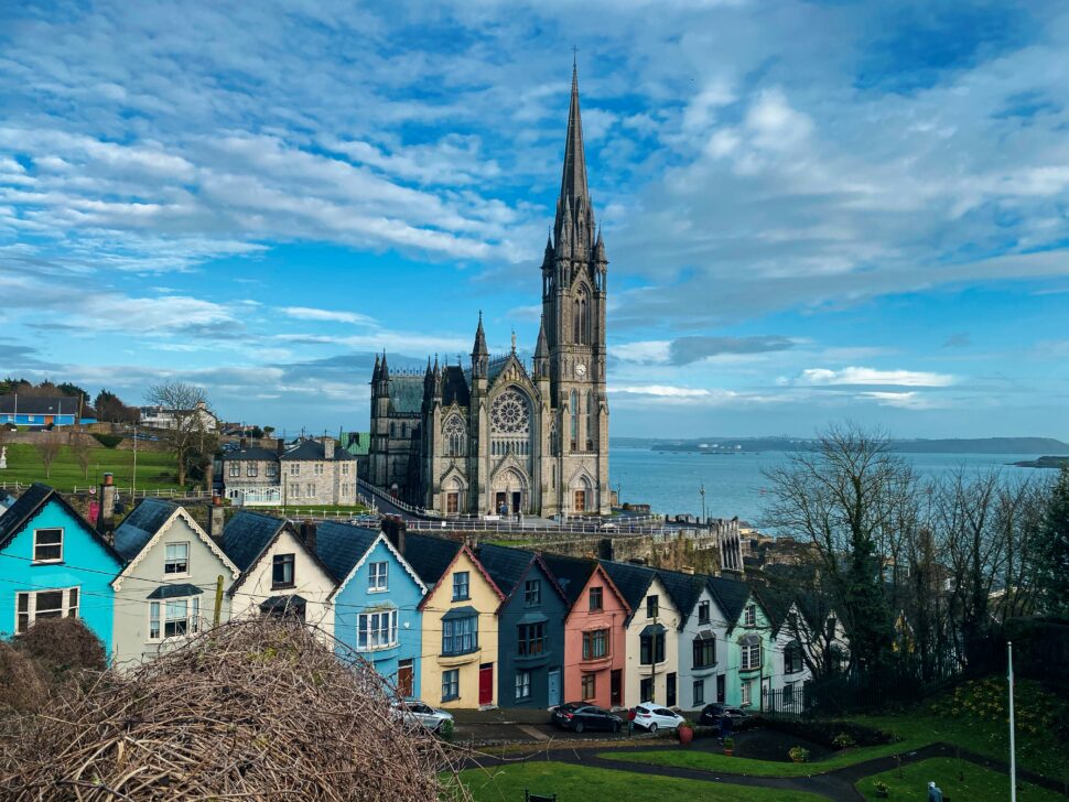
Best Time to Visit: Summer (June to August) or early fall (September to October)
Transportation Options: Train and bus connections from Dublin and other cities; local bus network.
It is Ireland’s second-largest city, known for its food scene and the English Market. Fun Fact: Cork Harbour is the second-largest natural harbor in the world after Sydney, Australia.
Things to Do: Go see the Blarney Stone at Blarney Castle, explore the English Market, visit the Cork City Gaol, and take a trip to nearby Cobh. Where to Eat: Sample local produce at the English Market, dine at the vegetarian paradise Café Paradiso, and enjoy fine dining at Greene’s Restaurant. Where to Stay: Consider riverside hotels like The River Lee or boutique options like The Imperial Hotel.
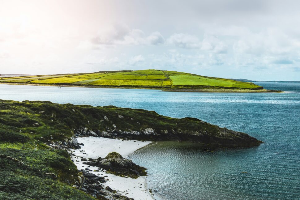
Transportation Options: Bus tours available; car rental recommended for exploring the region.
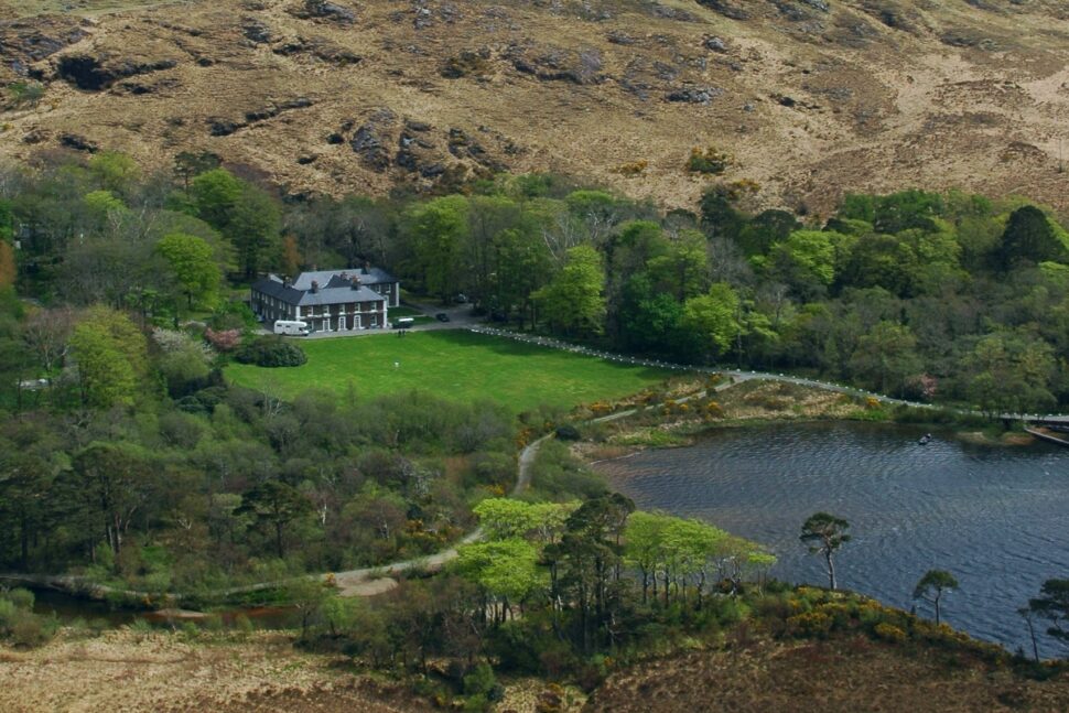
It is a beautiful place with mountains, lakes, and a National Park. Fun Fact: Connemara ponies, a native Irish breed, are well-adapted to the region’s harsh landscape.
Things to Do: Explore Connemara National Park, visit Kylemore Abbey, drive the Sky Road for stunning views, and take a boat trip on Killary Fjord. Where to Eat: Enjoy seafood at Mitchell’s Restaurant in Clifden, dine with a view at Renvyle House Hotel, and try local specialties at Misunderstood Heron food truck. Where to Stay: Consider castle hotels like Ballynahinch Castle or coastal retreats like Renvyle House Hotel.
Glendalough
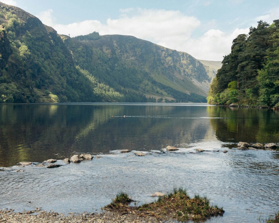
Transportation Options: Bus tours from Dublin; limited public transport, so car rental is often preferred.
This is an ancient monastic site with well-preserved round tower; scenic lakes and walking trails. Fun Fact: The name Glendalough means “Valley of Two Lakes” in Irish.
Things to Do: Explore the ancient monastic site, hike in the Wicklow Mountains National Park, visit the interpretive center, and enjoy the scenic lakes. Where to Eat: Dine at The Wicklow Heather Restaurant, enjoy pub fare at Lynhams of Laragh, and try local produce at The Glendalough Hotel Restaurant. Where to Stay: Consider nearby accommodations like Powerscourt Hotel Resort & Spa or charming B&Bs like Tudor Lodge .
Subscribe to travel noire
Get more travel content
Subscribe to Travel Noire, a free daily newsletter that features the best of travel, destinations, and guides to the cities you love from a new point of view — yours.
By subscribing to this newsletter, you agree to our terms of service and privacy policy.
Popular posts
Did You Know? Queen Elizabeth Once Stepped In To Prevent Snoop Dogg From Being Banned From The UK
United Airlines Flight Attendant's Armrest Announcement Sparks Social Media Frenzy
‘Basketball Wives’ Star Mehgan James Speaks Out About Popular Bahamas Island With Flesh-Eating Bacteria After Friend Loses Leg
Chaos Erupts After Ethiopian Airlines Passenger Forced To Give Up Seat For Minister
Trending stories in world travel
One of the best Italian restaurants in Boston is located on the North End of the city – Monica's Mercato & Salumeria.
Prince Harry and Meghan visited Colombia for the first time after receiving an invitation from Vice President Márquez.

"Whitening" aimed to increase the proportion of white Brazilians through European immigration and interracial marriages.

This list of travel gifts gets you in the fall spirit while also supporting small businesses and Black-owned brands.
A mother shared her difficult experience obtaining a passport for her daughter, Khaleesi, 6, who's named after a 'Game of Thrones' character.

- Places - European, Western and Northern Russia
KHANTY-MANSI AUTONOMOUS OKRUG: RUSSIA’S MAIN OIL-PRODUCING REGION
Khanty-mansi autonomous okrug.
Khanty-Mansi Autonomous Okrug is usually called Yugra or Ugra for short. It is named after two indigenous groups native to the region — the Khanty and the Mansi, known collectively as Ob-Ugric people. It covers 534,800 square kilometers (206,500 square miles), is home to about 1.53 million people and has a population density of 2.9 people per square kilometer. About 91.5 percent of the population live in urban areas. Khanty-Mansiysk is the capital, with about 80,000 people. The largest cities are Surgut, Nizhnevartovsk, and Nefteyugansk.
As of the early 2010s, about 51 percent of the oil produced in Russia and 7.3 percent of the world’s supply came from Khanty–Mansi Autonomous Okrug, making the region very important economically. More than 10 billion tons of oil has been was recovered from the okrug’s fields so far . The okrug contains around 70 percent of Russia’s developed oil fields, about 450 in total, including Samotlor, which is the largest oil field in Russia and the sixth largest in the world. Gas was first found in the region in 1953 and oil began to be produced in 1960.
As far as tourism is concerned this autonomous okrug combines unique historical, cultural and natural resources, the most important of which is the way of life of its indigenous peoples. If you visit a nomad camp, you can ride on a reindeer sleigh, live in a chum tent, learn to harness a deer, ride a sled and taste stroganina (slices of frozen meat) and patanka (thinly sliced frozen fish). In the Sub-Arctic Ural Mountains, it is popular to climb Mount Narodnaya — the highest peak of the Urals — and go fishing.
The winter in Khanty-Mansiysk is cold. Snow lies on the ground about 200 days of the year and temperature of -50 degrees, C are not unusual. The summer are short but sometimes can get surprisingly hot, with temperature over 30 degree heat. The best time to visit is May or or September, when it is not yet cold and the annoying mosquitos, no-see-ums and midges are not out in full force.
Getting There: By Plane: The flight Moscow or St. Petersburg to Khanty-Mansiysk is about three hours. To Surgut, three and a half. To Nizhnevartovsk, four hours. The cost of an adult round-trip economy class ticket is from 8,000 to 12,000 rubles, depending on the airline. The airport of Nizhnevartovsk. Website: /nvavia.ru. Phone +7 (3466) 49-21-75. By Train: you can reach Surgut, Nizhnevartovsk, Yugorsk, Nyagan and Kogalym. Trains do not reach Khanty-Mansiysk. The nearest station to it, Demyanka, is located 240 kilometers away. From it to the capital of Ugra there are minibuses. A round-trip ticket for a berth in a compartment from Moscow to Surgut is 14,000 rubles. The trip takes two days.
By Car: Two roads lead to Yugra. The main one is the Federal highway R404 Tyumen-Khanty-Mansiysk. This is convenient if you are going to the eastern part of the okrug. If you need to go to the western part or to the capital, it is better to go by the Northern route — through Perm, Serov, Ivdel and Yugorsk. The road quality on both routes is pretty good, but there is much less traffic on the northern one. If you are traveling in Ugra by car, do not forget to refueling. The distances gas stations can reach 200 kilometers or more. It is a good idea to have a canister of fuel in the trunk just in case. Regional Transport By Bus: From Khanty-Mansiysk to Surgut is 300 kilometers, Bus tickets range from 1100 to 1400 rubles. From Surgut to Nizhnevartovsk — 220 kilometers — bu bus costs about 1000 rubles. From Surgut to Kogalym — 80 kilometers — is about 500 rubles. The bus station in Nizhnevartovsk. Website: www.nvav.ru. Phone: 8 (3466) 45-72-97.
Accommodation in the Region: In all major cities there are a lot of hotels. The level of service is high everywhere, but the prices are also high: starting from 5,000-6,000 rubles for a standard price double room. It is much cheaper to rent apartments, at 1,500 to 2,500 rubles.
Khanty and Mansi
The Khanty (pronounced HANT-ee) are a group of Finno-Ugric-speaking, semi-nomadic reindeer herders. Also known as Ostyaks, Asiakh, and Hante they are related to the Mansi, another group of Finno-Ugric-speaking reindeer herders. Only about 60 percent of Khanty speak their native language and a much smaller percentage live in the forest. In the Khanty-Mansiisk District they are fa r outnumbered by other ethnic groups. [Source: John Ross, Smithsonian; Alexander Milovsky, Natural History, December, 1993]
There are about 23,000 Khanty. They live primarily in Khanty-Mansi Autonomous Okrug , a region along the northern tributaries of the Ob River in northwestern Siberia about 1,100 miles northwest of Moscow and 200 mile south of the Arctic Circle. Their cousins, the Mansi, also live there. The region has been damaged by oil and natural gas exploration and production.
The Mansi, known in the old days as the Voguls, are close relatives of the Khanty and live primarily in Khanty-Mansi Autonomous Okrug.. There are around 8,000 or so Mansi. The Mansi have traditionally survived by fishing, hunting and gathering, The hunting methods they employed and the animals they went after was determined by what was available. Often they relied chiefly on fishing and dried enough fish during the summer to last through the winter. They hunted elk, bears, wild reindeer with spears, bows and arrows and traps until the 19th century when the began using firearms. Elk were caught with a system of traps and triggered bows.
Many Mansi still hunt. They use dogs and firearms and go chiefly after muskrats and squirrels. Sable are hunted with nets and guns by a pair of hunters: one who flushes the sable from its den into the net and the other who shoots the animal. Their traditional religion is often aimed at securing a successful hunt.
KHANTY factsanddetails.com ;
Oil and Natural Gas in Khanty-Mansi Autonomous Okrug
Oil was prospected in the West Siberia from the beginning of the 20th century. Local people reported finding discharges on the surface from time to time. The first Soviet prospectors arrived to Ugra in 1935. They confirmed the presence of natural oil seeps on the Ugan river in the Surgut area. Over 2.5 tons of equipment were delivered to the drilling pad by air. Other supplies were hauled by horses, since the nearest railroad ran about 1,000 km away from the prospecting site. The place was very remote and was only accessible during the winter. The early workers lived in a camp under extremely cold conditions. [Source: Technologies Department of Ugra]
In 1953, natural gas was found for the first time in Western Siberia, in Berezovo, about 300 kilometers northwest of Khanty-Mansiysk. in Berezovo. In 1960 the first oil was found in the vicinity of Shaim. Soon after oil fields were discovered in Megion, West Surgut, Pokur, Vatinsky, Mamontovo, Salym, Pravdino and other places. The biggest discovery was in 1965, when the first oil gushed out from the marshland at Samotlor. One of the largest oil fields in the world, it has already produced 2.67 billion tons of oil.
Oil quality in the region is quite high. Some is light, some is black, but most of it is brown. Its characteristics and composition can differ significantly even within the same field. In 2013 255.1 million tons of oil were produced in Khanty-Mansi Autonomous Okrug and eight new fields were brought into development. Total gas production in Ugra was 33,0 billion cubic meters in 2013. This was mostly associated petroleum gas.
Owing to its explored and proven raw hydrocarbons resources, production capabilities, industrial infrastructure and oil fields commercial viability Yugra will remain Russia’s main strategic raw hydrocarbons resource base for the next several decades. Over 475 oil and gas fields have been discovered in the territory of the Khanty-Mansiysk Autonomous Okrug. Total length of the region's pipelines network is 107,000 kilometers.
Ob River (flowing northeast of Novosibirsk and Tomsk) is the forth longest river in the world if you include its major tributary the Irtysh River and the seventh longest without it. The westernmost of three great rivers of Asiatic Russia, the Ob is 3,650 kilometers (2,270 miles) long and is an important commercial waterway that transports goods back and forth between the Trans-Siberian Railway and the resource rich regions of northern Siberia. Since it is frozen over half the year activity on the river is concentrated mostly in the summer months. The Ob-Irtysh is over 5570 kilometers (3461 miles) long
The Ob and the Irtysh River begin in the Altay Mountains, a range located near where Russia, China, Kazakhstan and Mongolia all come together, and flow northward. Although the Ob and the Irtysh begin at points within a couple of hundred miles of one another the two rivers don't join until the Irytysh has traveled over 1,600 kilometers (1000 miles). Once the two rivers have dropped down out of the highlands the meander lazily through open steppes, then rich farmland, and meet in flat, swampy plains, where the width of river ranges between a half a kilometer and a kilometer and a half. The Ob then passes through fir and spruce forests of West Siberia, then through Arctic tundra before finally emptying into the Kara Sea, an arm of the Arctic Ocean. The Ob is one of the great Asiatic Russian rivers (the Yenisei and the Lena are the other two). According to the Guinness Book of World Records, it has the longest estuary (550 miles long and up to 50 miles wide) and is widest river that freezes solid. The mouth of the river on the Arctic Ocean is ice free only a couple of months a year. Huge flood sometimes form in the spring when high waters fed by melting snow and ice meet still frozen section of the river.
The main city on the Ob is Novosibirsk. Parts of the Ob are very polluted and nearly void of life. At the mouth of the river so much land has been degraded by gas exploration that huge chunks of permafrost land have literally melted into the sea. [Source: Robert Paul Jordan, National Geographic, February 1978, ♬]
Traveling on the Ob and Irtysh Rivers
There is a regualr ferry the Ob and Irtysh Rivers that travels between Omsk – Tobolsk – Khanty-Mansiysk – Berezovo and Salekhard (Yamal Nenets Autonomous Region). Omsk and Tobolsk both have train stations on the Trans-Siberian Railway. Khanti-Mansiysk is accessible by bus from Tyumen, which has a train station. After Khanti-Mansiysk you are beyond the road network. As well as the major stops listed on the route above, the boat also stops at plenty of isolated indigenous villages in between them. Salekhard is the only city in the world located exactly on the Arctic Circle.
The name of the ferry is the Rodina. It travels three times a month in June and September and four times a month in July and August. Going from Salekhard to Omsk: Day 1): departs Salekhard at 5:00pm; Dat 2) stops at Berezovo for 30 minutes ay 7:30pm; Day 3) stops at Oktobraskaya Market for one hour. Day 4) stops at Khanty-Mansiysk for two hours at 8:00am; Day 6) one hour stop in Tobolsk at 7:30. Day 9) arrive in Omsk at 3:00pm. Traveling the other direction, with the current, takes one third less time.
On the Salekhard - Tobolsk - Omsk trip on person posted on Lonely Planet’s Thorn Tree forum in 2013: “I'll start by saying that this boat is amazingly good value for money. Here some example prices. The first is for beds in the common area, similar to platzkart on the train, the second is for a bed in a private 4-, 6-, or 8 bed cabin and the third is for a bed in a private 2 bed cabin. 1) Salekhard - Omsk (8 days): 1162 / 1437 / 3926 roubles; 2) Salekhard - Tobolsk (5 days): 774 / 969 / 2632 roubles; 3) Tobolsk - Khanty-Mansiysk (2 days): 429 / 526 / 1394 roubles. Children go half price!
“Tickets can be bought in advance at the airport in Salekhard or on the boat itself an hour before departure (it's apparently never full). Most people get off at one of the stops in the first 24 hours when going south from Salekhard, leaving only one or two people in most of the cabins for most of the route. The beds are comfortable , both longer and wider than on trains. Everything is cleaned several times a day, there's a shower, laundry, restaurant with simple but tasty meals and alcohol. Breakfast about 70 roubles, lunch and dinner 150 - 300, beer 50 - 80, wine, vodka and so on also available. Theres also a small room where films are shown starting in the afternoon and a shop selling all sorts of useful stuff such as toiletries, mugs, books.
“You can walk around on deck as much as you want or sit and read a book on the benches up there. The scenery is more or less the same all the way - endless taiga forest with absolutely no sign of civilisation. There are a few villages such as Pitlyar for which the boat is their only access to the outside world and a couple of towns where you can get off the boat and walk around - Beryozovo 24 hours after Salekhard and Khanty-Manskiysk 3 days from Salekhard. From Khanty Mansiysk there are regular buses to Tyumen on the Trans Siberian which take 8 hours. At Tobolsk the boat stops next to the stunning kremlin, the only one in Siberia.
“Anyone can freely sail the whole route between Omsk and Pitlyar, a small village of 500 and the last stop before Salekhard. Salekhard and areas north are closed to outsiders, Russian or otherwise, unless they get a temporary permit. See the Yamal Peninsula link in my signature line for how to get this permit. Permit in hand, you can continue the journey north from Salekhard a further two days to Antipayuta, well beyond the Arctic Circle, with a similar level of comfort and price.
“It sails the whole route from June to September and once in October from Khanty-Mansiysk to Omsk. Check www.irsc.ru for timetables and fares. Only about half the boats from Salekhard go as far as Omsk, the rest stopping in Tobolsk. Eg in July and August, the most frequent sailing months, 6 boats go from Salekhard - Tobolsk each month but only 3 continue to Omsk. Check the timetable carefully when planning if you want to sail all the way to Omsk!”
Khanty-Mansiysk City
Khanty-Mansiysk is the capital of the Khanty-Mansiysk Autonomous Okrug and home to about 80,000 people. Despite its remote location and relatively small size, it has a Norman Foster skyscraper, world-leading medical center that is free and has hosted international film festivals, major sports events and political summits. How is this possible?: Oil wealth and close ties between local politicians and Russian President Vladimir Putin doesn’t hurt.
Khanty Mansiysk has showy headquarters for Russia’s main oil companies: Rosneft, Lukoil and Gazprom-Neft. Not far away enormous drilling towers rise and gas flares burn above the birch forests and pipelines cut through the landscape. Around 90 percent of the city’s economic revenues are tied directly to the oil and gas industries.
The city is located in a picturesque area of the West Siberian lowland, where steep hills overgrown with age-old dwarf pine, rise up from the right bank of the mighty Irtysh River. Two of the largest rivers of Siberia — the Irtysh and the Ob — merge twenty kilometers from the city. Not far from town the “Coniferous Urman” ski complex with a cable car. The cedar forest of the Samarovsky Chugas Park has trails for cross-country skiing and hiking. For children there is a water park and a small zoo in the village of Shapsha 20 kilometers from the city. In the summer, there are boat tours to the confluence of the Ob and Irtysh, where you can see the floating chapel-lighthouse.
Places of interest to tourists the gold domes of the Church of Christ’s Resurrection; the gallery of the artist Gennady Raishev; the Geology, Oil and Gas Museum, which traces the history of Western Siberian oil and gas development; and the open-air Archeopark, which has bronze sculptures of Pleistocene animals like mammoths and woolly rhinosl a sporting venue that hosts international ice and skiing events. A new triple concert hall dominates the center of the town. Servicing villages that cannot be reached by road, is an ultra-modern hospital ship that cruises Ob and Irtish rivers treating the sick on board. Complex operations are supervised by surgeons from the central hospital in Khanty-Mansiysk using TV monitors that relay pictures by satellite.
Accommodation: There are several hotels of different levels in Khanty-Mansiysk. The best service and, accordingly, the highest prices at the Ugra valley Valley Complex. At the Tarey business hotel prices start from 4800 rubles per night; at the Olympics Hotel, from 3000 rubles per night. If you want to save money, it is better to rent an apartment: a one-bedroom can be found in the area of 1500 rubles per day.
History of Khanty-Mansiysk City
The first written mention of the town of the Khanty Prince Samara, where the modern city of Khanty-Mansiysk is located, dates back to 1582. In 1637, a settlement of Russian coachmen was formed in the place of this town. It was named after the Prince Samara — Samarovsky Yam.
By the beginning of the 19th century, Samarovsky Yam turned into a large village of Samarovo and became the center of crafts and trade thanks to the favourable location on the river trade routes. In 1931, a few kilometers from the village of Samarovo, a workers settlement Ostyako-Vogulsk was built, which became the district center of the Ostyako-Vogulsk national district. The settlement began to be built up with new industrial enterprises, administrative buildings, apartment houses, public and cultural institutions. By the end of 1950s, pebble roads were laid in the settlement.
In 1940, Ostyako-Vogulsk was renamed Khanty-Mansiysk, and the district was renamed Khanty-Mansiysk, since at that time Ostyak tribes began to be called Khanty, and Voguls tribes — Mansi. In 1950, Khanty-Mansiysk received the status of a city, including Samarovo village. Since 1977, Khanty-Mansiysk has become the administrative center of the Khanty-Mansiysk Autonomous Okrug formed from the national district.
Sights in Khanty-Mansiysk
Torum Maa Open Air Museum (Ulitsa Sobyanina, 20, Khanty-Mansiysk) is located on one of the seven holy hills, in the Samarovsky Churas Nature Park, and features authentically reconstructed buildings and dwelling of indigenous peoples of the North, including a Mansi winter camp and traditional Khanty residential and household structures dating to the early-mid-19th century. You can learn more about hunting culture of the Khanty and Mansi on a special hiking trail.
At the museum you can find a 15th-17th century smithy, reconstructed using materials from archaeological excavations of Emder city; displays of idols and protectors of this land. The museum is especially active during traditional holidays of the Ob river Ugric people when Khanty and Mansi come from all over to celebrate. The most popular of these are: Tylasch pori (the Rite of Offering to the Moon), which takes place in February or March when the moon is waxing; Crow Day, which symbolizes the beginning of spring and is celebrated in April; the International Day of the World’s Indigenous Peoples, which is celebrated globally on August 9; and the main holiday for the museum staff and visitors — the anniversary of the Torum Maa Museum on October 30.
Archeopark Cultural and Tourist Complex (in Khanty-Mansiysk) covers 3.5 hectares near a rock outcropping and includes a geological monument, the Samarov Villiage Archaeological Monument (dating from the 11th-18th centuries), and a the Sculpture Park with giant bronze sculptures of mammoths and other Pleistocene-era animals and Paleolithic humans.
The park was set up where the bones of mammoths and other pre-historic animals have been found. The first large bones and tusks were found in the 19th century, when the northern region came to be called the “elephant homeland.” For local inhabitants, the archaeological findings along the river banks were not so uncommon. The bones had been in demand as a decorative material and therapeutic powder.
All the sculptures were created in cooperation with paleontologists, who made sure that the ancient inhabitants of this area look as authentic as possible. Some of the sculptures, for instance, rhinoceroses, were made in life size, while others are two to three times larger. The height of the largest sculpture in the Mammoth composition is eight meters. The sculptures are lit up at night. The little mammoth is named KoJourka. The sculpture probably has the world's only sign that prohibits mammoth climbing.
Sights Near Khanty-Mansiysk City
Floating Chapel-Beacon in Honor of Saint Nicholas (20 kilometers Khanty-Mansiysk) opened in 2013 near the confluence of two mighty Siberian rivers — the Ob and Irtysh. Blessed by Bishop Pavel of Khanty-Mansiysk and Surgut and consecrated by Kirill, Patriarch of Moscow and all Rus, it is Russia's first floating chapel-lighthouse. The chapel is eight meters high, it weighs 10 tons and is fixed on a pontoon. Below the cross crowning the chapel there is a beacon light. There are eight illuminated alcoves with icons. The chapel is not intended to hold a service inside. Only maintenance personnel looking after the power supply can moor to it.
Originally the idea of building the chapel was suggested by S. Sandulov, president of the local branch of the Association of Ports and River Transport Owners. For river transport workers the Ob-Irtysh confluence is a special place. And for the local people — Khanty and Mansi — this is a sacred area. However, for a long time there was no monument or sign to mark the place. At the confluence of the Ob and Irtysh people have traditionally made a wish by throwing a coin into the water. The water here is considered to be sacred and many tourists wash themselves with the water of the two rivers.
Silava Ethnographic Center (near Uray, 250 kilometers east of Khanty-Mansiysk) and the Ela Hoth community of indigenous peoples "was founded in 2008 to preserve features of the traditional culture and way of life on the site of the former village of New Silava. Visitors can participate in Mansi ceremonies and celebrations and Mansi cooking and engage in recreational activities such as skiing, sledding, tubing, ice sliding and riding a snowmobile "Buran" in the winter; and pick mushrooms, berries, medicinal plants and go boating in the summer. The center may difficult to get to.
Swimming is possible in the cold Konda River. You can also go hiking on eco-trails and participate in various types of fishing and children's entertainment programs. The community has assembled a small museum of household items and fishing items. You can see how fishing camps were set up and a functioning bread oven and a machine for weaving mats and try grinding flour at the mill and baking bread.
Priobskoye Field
The Priobskoye field (65 kilometers east of Khanty-Mansiysk, and 100 kilometers west of Nefteyugansk) is an oil field that occupies an area of 5,466 square kilometers (2,110 square miles. It is located along both banks of the Ob River, and is serviced by the town of
The field was discovered in 1982. The northern three-quarters of the field was controlled by YUKOS via unit Yuganskneftegaz, and began oil production in 2000. In 2004, Yuganskneftegaz was bought by Rosneft, which is now the operating company of that portion of the field. The southern quarter of the field was controlled by Sibir energy, which began a joint venture with Sibneft to develop the field, with volume production beginning in 2003. Sibneft subsequently acquired complete control of the field via a corporate maneuver to dilute Sibir's holding. Sibneft is now majority controlled by Gazprom and renamed Gazprom Neft.
In 2007, the field was producing 675,000 barrels per day: 550,000 barrels per day in the northern Rosneft area and 125,000 barrels per day in the southern Gazprom Neft area. For 2008, Rosneft reported a growth of production to 680,000 barrels per day, while Gazpromneft's share grew slightly. In 2009, Gazprom Neft produced 160,000 barrels per day in its share of the field. In September 2019, Russia’s finance ministry approved tax breaks for developing the Priobskoye oilfield, Russia’s largest, to oil giants Rosneft and Gazprom Neft, Alexei Sazano.
Surgut (300 kilometers east of Khanty-Mansiysk by road) located on the Ob River and is one of the few cities in Russia that has a larger population than the capital of its federal subject. It is home to about 375,000 people compared to 80,000 in Khanty-Mansiysk. Surgut is home to the largest port on the Ob River, the largest road-railway junction in northwest Siberia. Two of the world's most powerful power plants — the SDPP-1 (State District Power Plant 1) and SDPP-2 (State District Power Plant 2), which produce over 7,200 megawatts — are also there supply most of the region with relatively cheap electricity.
Surgut's economy is tied to oil production (the city is known as "The Oil Capital of Russia") and the processing of natural gas. The most important enterprises are the oil firm Surgutneftegaz and Surgutgazprom (a unit of Gazprom). The Surgut-2 Power Station providing Energy for the city is the largest gas-fired power station in the world. In addition, there are factories: gas processing, stabilization of condensate, motor fuel. Enterprises food (meat processing, dairy, etc.) industry, timber industry. Manufacture of building materials (production of reinforced concrete structures, etc.).
The city is served by the Surgut International Airport, which offers flights to Moscow, St. Petersburg, Dubai, Irkutsk, and a number of other cities. Through Surgut are trains to the east (in Novy Urengoy, Nizhnevartovsk), to the south-west (in Tyumen, Moscow, Novosibirsk, Ufa, Chelyabinsk, Yekaterinburg). Road P-404 connects Surgut with Tyumen. Places to stay in Surgut include the Ob, Den, Ark, and Center hotels
Old Surgut is a historical and ethnographic complex with 14 restored copies of wooden houses that once stood in the city. Among them “house of nature”, “House of local historian”, “house of Cossacks”, “House of indigenous peoples of the North” and others. Every winter, the center hosts a festival of ice sculptures.
Barsova Mountain Tract (west of Surgut) is located he state natural and archaeological park. Barosova Gora stretches for eight kilometers along the right Bank of the Ob river. Along the tract there are remains of ancient buildings, sanctuaries, burial grounds, some dating back to the Stone Age. In total, there are more than 400 archaeological sites on Barsova Mountain. It is better to visit this place in the summer or early autumn. The standard tour lasts about three hours.
Nefteyugansk
Nefteyugansk(30 kilometers west of Surgut) is located to south of the Ob River and is home to about 125,000, people. It was founded on October 16, 1967, after an oil field had been discovered on a small forest clearing in the middle of the taiga marshland in 1961. The main and the only big enterprise in the city, Yuganskneftegaz, was founded in February 1966. The name 'Yugansk' comes from the indigenous Khanty name of a small river near the city, neft' means oil in Russian, and gaz is natural gas.
The economy of the city remains petroleum-based, and was a major center for the Russian oil enterprise YUKOS, which owned Yuganskneftegaz. In fact, the "Yu" in "YUKOS" comes from the "yu" in "Nefteyugansk" and therefore from "Yuganskneftegaz". The other three letters come from the oil-refining factory "Kuibyshev-Org-Sintez", situated in Samara.
Nefteyugansk has been at the center of violence and drama involving YUKOS. On June 26, 1998, city mayor Vladimir Petukhov was shot dead on the way to his office. Before his murder, Petukhov had been on a hunger strike demanding that the chairmen of municipal and district tax offices be dismissed from their positions and a criminal case against Yukos be filed on counts of tax evasion. Petukhov's widow later on called for an investigation into Mikhail Khodorkovsky's role in events. Back then Khodorkovsky was head of Yukos. On September 20, 2005 Dmitry Yegortsev, acting mayor of Nefteyugansk, was assaulted and wounded with a knife. After the stabbing of Yegortsev, Igor Gribanov took over City Hall as acting mayor. Just a few months later, he died of carbon monoxide poisoning at his home on January 6, 2006. Since January 2005, Yuganskneftegaz has been owned by the state-owned oil company Rosneft. [Source: Wikipedia]
Hay Al Ruv Ethnographic Center of Indigenous Peoples of the North is an 1.5-hectare open air ethnographic which recreates the Khanty camp and has a house, storage shed, traditional tent, "red" tent for visitors and a bread oven.
Nizhnevartovsk
Nizhnevartovsk (220 kilometers east of Surgut) is home to about 250,000 people. Since the 1960s, the town has grown rapidly in the coat-tails of the Western Siberian oil boom due to its location beside the Samotlor oil field along the right bank of the Ob River. The presence of the petroleum industry has made it one of the wealthiest cities in Russia. Accommodation is available at the Hope, Aviator, Venice and Waters hotels.
Nizhnevartovsk is situated in the Sredneobskaya Lowland of West Siberian Plain, in the middle course of the Ob River on its northern bank. It remained a relatively small settlement until the 1960s when the Soviet authorities began widespread prospecting for the petroleum industry in the Western Siberia region, discovering the Samotlor oil field, one of the largest oil fields in the world, beneath the nearby Lake Samoltor to the north of Nizhnevartovsk. During the early boomtown years, Komsomol volunteers were brought in from across the country to construct the city, whose population soared from 2300 people in 1959 to 15,663 in 1970.
Lake Samotlor is the home of the massive Samotlor oil field. A visit to the lake is part of a local oil tour, during which you can see how oil is produced, and study the history of the development of fields in Western Siberia. Tourists visit the Samotlor oil field, the school of drilling masters and eat in the dining room with the oilmen. The tours are hard to arrange on the spot, They need to booked in advance through a travel company. Oil tours can be combined with a visit to a Khanty camp.
Samotlor Field
Samotlor Field (near Nizhnevartovsk) is the largest oil field of Russia and the sixth largest in the world. Owned and operated by Rosneft, it is located at Lake Samotlor in Nizhnevartovsk district and covers 1,752 square kilometers (676 square miles). The field was discovered in 1965; development began in 1967 and first oil was produced in 1969. Nearby Nizhnevartovsk went from being a small village into a booming oil city as Samotlor became the most important oil production base of the Soviet Union. After breakup of the Soviet Union the field was owned by Samotlorneftgaz and TNK-Nizhnevartovsk, which later formed TNK-BP.
At Samotlor Field a total of 2,086 well clusters (containing more than 17,000 wells) have been built and about 2.6 billion tons of oil has been produced. The peak production occurred in 1980 when Samotlor produced 158.9 million tons of oil. Production has been in decline ever since, although according to TNK-BP the field production has stabilized over the past few years.
The proven reserves are approximately 44 billion barrels. The field is 80 percent depleted with water-cut exceeding 90 percent. At the end of the 1990s, production rate dropped to 300,000 barrels per day. However, through an aggressive exploration program and application of cutting-edge technologies TNK-BP had raised production up to 750,000 barrels per day. TNK-BP plans to invest US$1 billion per year for maintaining oil production at the level of 30 million tons per year. The production of oi in 2012 was 332,782 barrels per day. The estimated oil in place is 4 billion barrels. The oil comes from Cretaceous formations.
Ural Mountains
Ural Mountains are the traditional dividing line between Europe and Asia and have been a crossroads of Russian history. Stretching from Kazakhstan to the fringes of the Arctic Kara Sea, the Urals lie almost exactly along the 60 degree meridian of longitude and extend for about 2,000 kilometers (1,300 miles) from north to south and varies in width from about 50 kilometers (30 miles) in the north and 160 kilometers (100 miles) the south. At kilometers 1777 on the Trans-Siberian Railway there is white obelisk with "Europe" carved in Russian on one side and "Asia" carved on the other.
The eastern side of the Urals contains a lot of granite and igneous rock. The western side is primarily sandstone and limestones. A number of precious stones can be found in the southern part of the Urals, including emeralds. malachite, tourmaline, jasper and aquamarines. The highest peaks are in the north. Mount Narodnaya is the highest of all but is only 1884 meters (6,184 feet) high. The northern Urals are covered in thick forests and home to relatively few people.
Like the Appalachian Mountains in the eastern United States, the Urals are very old mountains — with rocks and sediments that are hundreds of millions years old — that were one much taller than they are now and have been steadily eroded down over millions of years by weather and other natural processes to their current size. According to Encyclopedia Britannica: “The rock composition helps shape the topography: the high ranges and low, broad-topped ridges consist of quartzites, schists, and gabbro, all weather-resistant. Buttes are frequent, and there are north–south troughs of limestone, nearly all containing river valleys. Karst topography is highly developed on the western slopes of the Urals, with many caves, basins, and underground streams. The eastern slopes, on the other hand, have fewer karst formations; instead, rocky outliers rise above the flattened surfaces. Broad foothills, reduced to peneplain, adjoin the Central and Southern Urals on the east.
“The Urals date from the structural upheavals of the Hercynian orogeny (about 250 million years ago). About 280 million years ago there arose a high mountainous region, which was eroded to a peneplain. Alpine folding resulted in new mountains, the most marked upheaval being that of the Nether-Polar Urals...The western slope of the Urals is composed of middle Paleozoic sedimentary rocks (sandstones and limestones) that are about 350 million years old. In many places it descends in terraces to the Cis-Ural depression (west of the Urals), to which much of the eroded matter was carried during the late Paleozoic (about 300 million years ago). Found there are widespread karst (a starkly eroded limestone region) and gypsum, with large caverns and subterranean streams. On the eastern slope, volcanic layers alternate with sedimentary strata, all dating from middle Paleozoic times.”
The fauna of the vertebrate animals in the Reserve includes 19 fish, 5 amphibian and 5 reptile. Among the 48 mammal species are elks, roe deer, boars, foxes, wolves, lynxes, badgers, common weasels, least weasels, forest ferrets, Siberian striped weasel, common marten, American mink. Squirrels, beavers, muskrats, hares, dibblers, moles, hedgehogs, voles are quite common, as well as chiropterans: pond bat, water bat, Brandt's bat, whiskered bat, northern bat, long-eared bat, parti-coloured bat, Nathusius' pipistrelle. The 174 bird bird species include white-tailed eagles, honey hawks, boreal owls, gnome owls, hawk owls, tawny owls, common scoters, cuckoos, wookcocks, common grouses, wood grouses, hazel grouses, common partridges, shrikes, goldenmountain thrushes, black- throated loons and others.
Mount Narodnaya: the Highest Mountain in the Urals
Mount Narodnaya (700 kilometers northwest of Khanty-Mansiysk) is the highest mountain in the Urals. Also known as Naroda and Poenurr and "People's Mountain", it is 1,894 meters (6,214 feet) high. It lies in in Khanty–Mansi Autonomous Okrug but is only 500 meters east from the border of Komi Republic. The name is derived from the nearby Naroda River.
Mount Narodnaya is the highest point in European Russia outside the Caucasus and rises 1,772 meters (5,814 ft) above the landscape. Narodnaya is located in the Ural mountains water divide, and therefore on the border between Europe and Asia: The mountain is formed with quartzites and metamorphosed slates of the Proterozoic Eon and Cambrian Period. There are some glaciers on the mountain. Also, there are sparse forests of larch and birch in the deep valleys at the foot of the mountain. The slopes of the mountain are covered with highland tundra.
Mount Narodnaya was identified in 1927. If you ascend from the territory of Ugra, you first need to get to the village of Saranpaul (by helicopter from Berezovo, in the winter you can snowmobile), then about 180 kilometers to overcome by all-terrain transport to the camp site “Desired”, where you can climb Narodnaya and Manaragu. The cost of the tour, depending on the time of year, transport and service varies from 15,000 to 200,000 rubles, with a lot of the cost depending on whether you use a helicopter or not..
The easiest route to the summit is a technically easy hike on the moderate north-west slope. Depending on snow and ice conditions, crampons may be required. The south wall of Narodnaya is steeper and less commonly used to reach the summit. Accommodation: The cost of living at the camp site “Desired” — from 2300 rubles per day. In the forest in tent-for free.
Numto Natural Park
The Numto Natural Park (400 kilometers north of Surgut) is in the center of the Western-Siberian plain. The park covers 7,217 square kilometers and was created in 1997 to preserve the unique natural complexes of the Siberian Uvaly and protect the places where the the northern Khanty and forest Nenets live and work. The area is also inhabited by many animals and birds included osprey, white-tailed eagle, golden eagle, red-footed falcon, gyrfalcon, and others.
Because of its remoteness and difficulty to access, the Numto lake area remained a “blank space” during the development of Siberia. It was explored properly only in the early 20th century. It was first described by A. Dunin-Gorkavitch, who reached the place with reindeer teams in November 1901. He wrote: “Thus, during this journey I was able to explore the Kazym River and the watersheds of four other rivers: Kazym and Nadym on one side, Pima and Trom-Yugan on the other, as well as the Samoyed Lake Numto, known as “the lake of God”. The lake is located at the following coordinates: 63°30'N 41°30'E. It's oval in shape and has a narrow sandy spit from the northwest”.
The traveler gives a rather detailed description of some of the area's features: “...to the south from the lake, some 35 kilometers away, there is a watershed of four- rivers, from which the Kazym River begins. The watershed area is actually a tundra with huge hills up to 64 meters high with bogs in between. And these very bogs have springs and that is where the rivers Kazym, Nadym, Pim, and Trom-Yugan begin”.
Numto Lake was a kind of a sanctuary for peoples of the northern Ob. It was worshiped like a living creature. Even fishing was prohibited there. Some of these religious bans still exist; for example, it is not permitted to chop ice with an axe, fix anchoring poles in the lake bottom or block the connection between the lake and the Ukhlor Gulf with nets. With the coming of the winter, the Khanty and Nenets people come to Holy Island to offer a deer in sacrifice.
Image Sources: Wikimedia Commons
Text Sources: Federal Agency for Tourism of the Russian Federation (official Russia tourism website russiatourism.ru ), Russian government websites, UNESCO, Wikipedia, Lonely Planet guides, New York Times, Washington Post, Los Angeles Times, National Geographic, The New Yorker, Bloomberg, Reuters, Associated Press, AFP, Yomiuri Shimbun and various books and other publications.
Updated in September 2020
- Google+
Page Top
This site contains copyrighted material the use of which has not always been authorized by the copyright owner. Such material is made available in an effort to advance understanding of country or topic discussed in the article. This constitutes 'fair use' of any such copyrighted material as provided for in section 107 of the US Copyright Law. In accordance with Title 17 U.S.C. Section 107, the material on this site is distributed without profit. If you wish to use copyrighted material from this site for purposes of your own that go beyond 'fair use', you must obtain permission from the copyright owner. If you are the copyright owner and would like this content removed from factsanddetails.com, please contact me.
Khanty-Mansi Autonomous Okrug
Khanty-Mansi Autonomous Okrug — Yugra [lower-alpha 1] , commonly shortened to Khantia-Mansia, is a federal subject of Russia (an autonomous okrug of Tyumen Oblast ). It has a population of 1,532,243 as of the 2010 Census . [4] Its administrative center is located at Khanty-Mansiysk .
Administrative divisions
Demographics, settlements, ethnic groups, vital statistics, external links.
The peoples native to the region are the Khanty and the Mansi , known collectively as Ob-Ugric peoples , but today the two groups only constitute 2.5% of the region's population. The local languages, Khanty and Mansi , are part of the Ugric branch of the Finno-Ugric language family, and enjoy a special status in the autonomous okrug. Russian remains the only official language.
In 2012, the majority (51%) [7] of the oil produced in Russia came from Khanty-Mansi Autonomous Okrug, giving the region great economic importance in Russia and the world. It borders Yamalo-Nenets Autonomous Okrug to the north, Komi Republic to the northwest, Sverdlovsk Oblast to the west, Tyumen Oblast to the south, Tomsk Oblast to the south and southeast and Krasnoyarsk Krai in the east.
The okrug was established on December 10, 1930, as Ostyak-Vogul National Okrug ( Остя́ко-Вогу́льский национа́льный о́круг ). In October 1940, it was renamed the Khanty-Mansi National Okrug . In 1977, along with other national okrugs of the Russian SFSR , it became an autonomous okrug (Khanty-Mansi Autonomous Okrug). In 2003, the word " Yugra " was appended to the official name. [8]

The okrug occupies the central part of the West Siberian Plain .
Principal rivers include the Ob and its tributaries Irtysh and Vatinsky Yogan . There are numerous lakes in the okrug, the largest ones are Numto , Tormemtor , Leushinsky Tuman and Tursuntsky Tuman , among others. [9]
The northeasterly line of equal latitude and longitude traverses the Khanty-Mansi Autonomous Okrug.
Population : 1,674,676 (2020); [10] 1,532,243 ( 2010 Russian census ) ; [4] 1,432,817 ( 2002 Census ) ; [11] 1,268,439 ( 1989 Soviet census ) . [12]
Khanty-Mansi Autonomous Okrug has an area of 523,100 km 2 , but the area is sparsely populated. The administrative center is Khanty-Mansiysk , but the largest cities are Surgut , Nizhnevartovsk , and Nefteyugansk .
The Indigenous population ( Khanty , Mansi , Komi , and Nenets ) is only 2.8% of the total population in the Khanty-Mansi Autonomous Okrug. The exploitation of natural gas in Khanty-Mansi Autonomous Okrug has attracted immigrants from all over the former Soviet Union. The 2021 Census counted 17 ethnic groups of more than five thousand persons each. The ethnic composition is as follows:
Population of Khanty-Mansi Autonomous Okrug: [13]
Historical population figures are shown below:

Source: [15]

According to a 2012 survey [16] 38.1% of the population of Yugra adheres to the Russian Orthodox Church , 5% are unaffiliated generic Christians , 1% of the population adheres to the Slavic native faith (Rodnovery) or to Khanty-Mansi native faith. Muslims (mostly Tatars ) constitute 11% of the population. In addition, 23% of the population declares to be spiritual but not religious , 11% is atheist , and 10.9% follows other religions or did not give an answer to the question. [16] According to recent reports Jehovah's Witnesses have been subjected to torture and detention in Surgut. [18]
In Khanty-Mansi Autonomous Okrug, the primary transport of goods is by water and railway transport; 29% is transported by road, and 2% by aviation. The total length of railway tracks is 1,106 km. The length of roads is more than 18,000 km.
- Hockey Club Ugra
- List of Chairmen of the Duma of the Khanty-Mansi Autonomous Okrug
Related Research Articles

Khanty-Mansiysk is a city in west-central Russia. Technically, it is situated on the eastern bank of the Irtysh River, 15 kilometers (9.3 mi) from its confluence with the Ob, in the oil-rich region of Western Siberia. Though it is an independent city, Khanty-Mansiysk also functions as the administrative centre of Khanty-Mansiysky District, and the administrative center of Khanty-Mansi Autonomous Okrug–Yugra.
Nyagan is a town in the northwest of Khanty–Mansi Autonomous Okrug, Russia, located near the Ob River and 230 kilometers (140 mi) northwest of Khanty-Mansiysk. It is named after the Nyagan-Yugan River, a tributary of the Ob River. Population: 63,034 (2021 Census) ; 54,890 (2010 Russian census) ; 52,610 (2002 Census) ; 54,061 (1989 Soviet census) .

Megion is a town in Khanty-Mansi Autonomous Okrug–Yugra, Russia, located at the altitude of 45 meters (148 ft) above sea level, on the right bank of the Ob River, 380 kilometers (240 mi) east of Khanty-Mansiysk and 760 kilometers (470 mi) northeast of Tyumen. The area of the town is 50.51 square kilometers (19.50 sq mi) and the nearest airport is in Nizhnevartovsk. Population: 49,449 (2010 Russian census) ; 46,566 ; 39,783 (1989 Soviet census) .

Yugorsk is a town in Khanty–Mansi Autonomous Okrug, Russia, located in the northwestern part of the East-West lowland, 420 kilometers (260 mi) from Khanty-Mansiysk. Population: 34,067 (2010 Russian census) ; 30,285 (2002 Census) ; 24,928 (1989 Soviet census) .

Sovetsky is a town and the administrative center of Sovetsky District in Khanty-Mansi Autonomous Okrug, Russia, located 470 kilometers (290 mi) west of Khanty-Mansiysk, the administrative center of the autonomous okrug. Population: 26,495 (2010 Russian census) ; 23,230 (2002 Census) ; 21,123 (1989 Soviet census) .
Lyantor is a town in Surgutsky District of Khanty–Mansi Autonomous Okrug, Russia, located on the Pim River, 625 kilometers (388 mi) northeast of Khanty-Mansiysk, the administrative center of the autonomous okrug. Population: 38,992 (2010 Russian census) ; 33,011 (2002 Census) ; 22,071 (1989 Soviet census) .

Pokachi is a town in Khanty–Mansi Autonomous Okrug, Russia, located on the right bank of the Vatyegan River, 350 kilometers (220 mi) east of Khanty-Mansiysk and 800 kilometers (500 mi) northeast of Tyumen. Population: 17,171 (2010 Russian census) ; 17,017 (2002 Census) ; 11,536 (1989 Soviet census) .
Kogalym is a town in Khanty-Mansi Autonomous Okrug, Russia, located on the Inguyagun River 325 kilometres (202 mi) northeast of Khanty-Mansiysk. Population: 58,181 (2010 Russian census) ; 55,367 (2002 Census) ; 44,297 (1989 Soviet census) .

Beloyarsky is a town and the administrative center of Beloyarsky District in Khanty-Mansi Autonomous Okrug, Russia, located on the Kazim River, northwest of Khanty-Mansiysk, the administrative center of the autonomous okrug. Population: 20,283 (2010 Russian census) ; 18,721 (2002 Census) ; 20,534 (1989 Soviet census) .

Raduzhny is a town in Khanty-Mansi Autonomous Okrug, Russia, located on the Agan River, 475 kilometers (295 mi) northeast of Khanty-Mansiysk and 975 kilometers (606 mi) northeast of Tyumen. Population: 43,399 (2010 Russian census) ; 47,060 ; 43,726.

Pyt-Yakh is a town in Khanty–Mansi Autonomous Okrug, Russia, located on the east bank of the Bolshoy Balyk River, southeast of Khanty-Mansiysk. Population: 41,488 (2010 Russian census) ; 41,813 (2002 Census) ; 17,101 (1989 Soviet census) .

Beloyarsky District is an administrative and municipal district (raion), one of the nine in Khanty-Mansi Autonomous Okrug of Tyumen Oblast, Russia. It is located in the north of the autonomous okrug. The area of the district is 41,574 square kilometers (16,052 sq mi). Its administrative center is the town of Beloyarsky. Population: 9,766 ; 9,493 (2002 Census) ; 8,927 (1989 Soviet census) .

Khanty-Mansiysky District is an administrative and municipal district (raion), one of the nine in Khanty-Mansi Autonomous Okrug, Russia. It is located in the center of the autonomous okrug. The area of the district is 46,400 square kilometers (17,900 sq mi). Its administrative center is the town of Khanty-Mansiysk. As of the 2010 Census, the total population of the district was 19,362.

Kondinsky District is an administrative and municipal district (raion), one of the nine in Khanty-Mansi Autonomous Okrug of Tyumen Oblast, Russia. It is located in the south of the autonomous okrug. The district is 55,170 square kilometers (21,300 sq mi). Its administrative center is the urban locality of Mezhdurechensky. Population: 34,494 ; 35,018 (2002 Census) ; 36,640 (1989 Soviet census) . The population of Mezhdurechensky accounts for 32.1% of the district's total population.

Nizhnevartovsky District is an administrative and municipal district (raion), one of the nine in Khanty-Mansi Autonomous Okrug, Russia. The area of the district is 118,500 square kilometers (45,800 sq mi). Its administrative center is the city of Nizhnevartovsk. Population: 35,745 ; 33,508 (2002 Census) ; 28,288 (1989 Soviet census) .

Oktyabrsky District is an administrative and municipal district (raion), one of the nine in Khanty-Mansi Autonomous Okrug of Tyumen Oblast, Russia. It is located in the western central part of the autonomous okrug. The area of the district is 24,500 square kilometers (9,500 sq mi). Its administrative center is the urban locality of Oktyabrskoye. As of the 2010 Census, the total population of the district was 32,224, with the population of Oktyabrskoye accounting for 11.3% of that number.

Sovetsky District is an administrative and municipal district (raion), one of the nine in Khanty-Mansi Autonomous Okrug of Tyumen Oblast, Russia. It is located in the southwest of the autonomous okrug. The area of the district is 29,768.74 square kilometers (11,493.77 sq mi). Its administrative center is the town of Sovetsky. Population: 48,059 ; 44,720 (2002 Census) ; 73,247 (1989 Soviet census) . The population of the administrative center accounts for 55.1% of the district's total population.

Surgutsky District is an administrative and municipal district (raion), one of the nine in Khanty-Mansi Autonomous Okrug, Russia. It is located in the center of the autonomous okrug. The area of the district is 105,190 square kilometers (40,610 sq mi). Its administrative center is the city of Surgut. Population: 113,515 ; 106,624 (2002 Census) ; 74,685 (1989 Soviet census) .

Uray a town in Khanty–Mansi Autonomous Okrug, located on the Konda River 350 kilometres (220 mi) from Khanty-Mansiysk. Population: 39,457 (2010 Russian census) ; 38,872 (2002 Census) ; 37,198 (1989 Soviet census) .

Agirish is an urban-type settlement in Sovetsky District of Khanty-Mansi Autonomous Okrug, Russia. Population: 2,856 (2010 Russian census) ; 2,831 (2002 Census) ; 3,592 (1989 Soviet census) .
- ↑ Russian and Mansi : Ханты-Мансийский автономный округ — Югра, Khanty-Mansiyskiy avtonomnyy okrug — Yugra; Khanty : Хӑнты-Мансийской Aвтономной Округ
- ↑ Президент Российской Федерации. Указ №849 от 13 мая 2000 г. «О полномочном представителе Президента Российской Федерации в федеральном округе». Вступил в силу 13 мая 2000 г. Опубликован: "Собрание законодательства РФ", No. 20, ст. 2112, 15 мая 2000 г. (President of the Russian Federation. Decree # 849 of May 13, 2000 On the Plenipotentiary Representative of the President of the Russian Federation in a Federal District . Effective as of May 13, 2000.).
- ↑ Госстандарт Российской Федерации. №ОК 024-95 27 декабря 1995 г. «Общероссийский классификатор экономических регионов. 2. Экономические районы», в ред. Изменения №5/2001 ОКЭР. ( Gosstandart of the Russian Federation. # OK 024-95 December 27, 1995 Russian Classification of Economic Regions. 2. Economic Regions , as amended by the Amendment # 5/2001 OKER. ).
- 1 2 3 Russian Federal State Statistics Service (2011). Всероссийская перепись населения 2010 года. Том 1 [ 2010 All-Russian Population Census, vol. 1 ] . Всероссийская перепись населения 2010 года [2010 All-Russia Population Census] (in Russian). Federal State Statistics Service .
- ↑ "Об исчислении времени" . Официальный интернет-портал правовой информации (in Russian). June 3, 2011 . Retrieved January 19, 2019 .
- ↑ Official throughout the Russian Federation according to Article 68.1 of the Constitution of Russia .
- ↑ В Ханты-Мансийском автономном округе добыта 10-миллиардная тонна нефти
- ↑ "Decree of the President of the Russian Federation of July 25, 2003 No. 841" (in Russian). Official website of the President of Russia .
- ↑ Google Earth
- ↑ 2020 Russian Subjects Population
- ↑ Federal State Statistics Service (May 21, 2004). Численность населения России, субъектов Российской Федерации в составе федеральных округов, районов, городских поселений, сельских населённых пунктов – районных центров и сельских населённых пунктов с населением 3 тысячи и более человек [ Population of Russia, Its Federal Districts, Federal Subjects, Districts, Urban Localities, Rural Localities—Administrative Centers, and Rural Localities with Population of Over 3,000 ] (XLS) . Всероссийская перепись населения 2002 года [All-Russia Population Census of 2002] (in Russian).
- ↑ Всесоюзная перепись населения 1989 г. Численность наличного населения союзных и автономных республик, автономных областей и округов, краёв, областей, районов, городских поселений и сёл-райцентров [ All Union Population Census of 1989: Present Population of Union and Autonomous Republics, Autonomous Oblasts and Okrugs, Krais, Oblasts, Districts, Urban Settlements, and Villages Serving as District Administrative Centers ] . Всесоюзная перепись населения 1989 года [All-Union Population Census of 1989] (in Russian). Институт демографии Национального исследовательского университета: Высшая школа экономики [Institute of Demography at the National Research University: Higher School of Economics]. 1989 – via Demoscope Weekly .
- ↑ "Russian Census of 2021" . (in Russian)
- ↑ Перепись-2010: русских становится больше Archived December 25, 2018, at the Wayback Machine . Perepis-2010.ru (2011-12-19). Retrieved on 2013-08-20.
- ↑ Russian Federal State Statistics Service
- 1 2 3 "Arena: Atlas of Religions and Nationalities in Russia" . Sreda, 2012.
- ↑ 2012 Arena Atlas Religion Maps . "Ogonek", № 34 (5243), 27/08/2012. Retrieved 21/04/2017. Archived .
- ↑ "7 Jehovah's Witnesses Brutally Tortured in Russia, Spokesman Says" . February 20, 2019.
- Official website of Khanty-Mansiysk Autonomous Okrug – Yugra Archived June 6, 2017, at the Wayback Machine
- Official site of Khanty-Mansi Duma (in Russian)
- Informational website of Khanty-Mansiysk Autonomous Okrug – Yugra (in Russian)

IMAGES
COMMENTS
Daily Tours to Giant's Causeway. 2022 TripAdvisor Travellers Choice Award Winner! ... Bus & Coach NI Excellence in Customer Care & Best Coach. 2014; Luxury Coach Hire & Customised Tours 2 Lynda Meadows Newtownabbey Co. Antrim BT37 0AT Tel 028 9086 6162 [email protected].
Full Description. Travel in a luxury coach on our 5 star rated Giants Causeway tour from Belfast - discover the full causeway coastal route on your 9:00 am central Belfast departure. The first stop of the day is Carrickfergus castle built by the Normans in 1177 AD, which has stood the test of time and still looks incredible even today 800 years on.
The Giant's Causeway is the highlight of this trip for most! Built by the Irish giant Fionn and his Scottish rival Angus, it is a real masterpiece formed of perfectly shaped hexagonal columns. Your tour guide shall tell you all about the Causeway, and the legends. The path to the causeway stones starts behind the center, it is only 10 mins walk!
Our guided bus tours offer award winning Giant's Causeway tours from Belfast, giving you the perfect way to take in the sights while learning about their rich history. Tour Information. Very friendly and welcoming driver with excellent knowledge of the local area. Had adequate time at each stop, wasn't rushed but equally didn't have to hang ...
4. Giants Causeway tour from Belfast. Travel along the Antrim coast with stops along the way. £18.00 Special Offer! Enjoy our award-winning bus tours.
Discover the magic of the UNESCO World Heritage-listed Giant's Causeway on a full-day trip from Belfast. Accompanied by a guide, travel by luxury coach through Northern Ireland's spectacular countryside. Then arrive at the Giant's Causeway and discover its natural beauty, as well as the Carrickfergus Castle, the Dark Hedges, and the Caves of Cushendun.
Tour overview. Join our 5-star rated Giant's Causeway day tour from Belfast, travelling in a luxury air-conditioned coach where you will discover the beauty of County Antrim, visiting the UNESCO World Heritage Giant's Causeway stones. The tour also takes in the Antrim Coast Road, one of the top five scenic roads in the world with ...
Excellent day trip to the Giants causeway, our coach driver Sean was amazing talked all the way, giving loads of information regarding the stops along the way, the coastal road, game of thrones, Dark Hedges, and N Ireland in general. ... The bus takes you from Belfast to Giant's Causeway via the stops published on the city tours website. The ...
After the Giant's Causeway, stop at the ancient ruins of Dunluce Castle, a castle ruin unlike any other in the world. Spend 30 minutes at Ireland's oldest whiskey distillery, Bushmills. Visit the gift shop or enjoy a taste of this world-famous and critically acclaimed whiskey. The final stop of the day is at the stunning Dark Hedges, so ...
The Giant's Causeway is Northern Ireland's only UNESCO World Heritage site and the natural wonder makes a popular choice for a day trip, located along the scenic Antrim Coast Road. This full-day tour from Belfast makes it possible to maximize your time, combining a tour of the Giant's Causeway with visits to nearby attractions such as Carrickfergus Castle and Dunluce Castle.
Get to Giant's Causeway with ease on this hassle-free guided tour from Belfast. Save yourself the stress of driving and ride in a luxury coach instead. As well as seeing the UNESCO World Heritage Site of Giant's Causeway, the trip also showcases the Dark Hedges, Dunluce Castle, Carrickfergus Castle, Carnlough, and the Caves of Cushendun.
Giant's Causeway and Titanic Belfast Tour. Spend around 2 hours at Giant's Causeway. Includes entry ticket to the Titanic Belfast Museum. Visit the Dark Hedges (a popular GOT filming site). Photo stop at the Dunluce Castle's ruins. Giants Causeway Express Tour. Private half-day tour for up to 6 people.
Leave Ireland with memories of the beautiful countryside, unique heritage, and a full understanding of the meaning and significance of many beautiful sites. Let Allen's Tours make your trip the best one yet. Book a Giant's Causeway Belfast bus tour today and get ready for an educational and adventurous day full of charm and wonder.
Tour the coastline of Northern Ireland on a day trip from Dublin in a comfortable bus. Visit iconic sights, including the Giant's Causeway, the Dark Hedges, Dunluce Castle, and Belfast. Depart Dublin and travel North, stopping at a service station along the way for breakfast, to buy lunch, and to stretch your legs.
T. he Giant's Causeway was formed 50 million years ago, yet still captures the imagination of people around the world today.. Made up of over 40,000 basalt columns, the Causeway truly is a sight to behold and continues to be the only UNESCO heritage site in Ireland. Having inspired storytellers of all kinds over the years, our Giant's Causeway Tour will talk you through the richly detailed ...
We will take the Giants Causeway Bus Tour in reverse. All the other Tour operators finish the Tour at the Giants Causeway, this way we avoid the convoy of buses and queues on cruise ship days. We use 35 and 50 seat coaches. All Giants Causeway Tours will be picked up at and returned to Belfast Port.
Giants Causeway Tours. Giants Causeway Day Tour (Small Group) Giants Causeway Day Tour; Shore Excursions. ... Giants Causeway Bus Tour From Belfast April 28, 2022 - 6:24 am; New Giants Causeway Bus Tour April 28, 2022 - 12:26 am; Game of Thrones filming locations in Ireland April 27, 2022 - 5:55 pm
Phone: +44 (0)7732961974. Email: [email protected]. Whatsapp: +447802902296. Belfast Causeway. Delve into Northern Ireland's rich history and scenic beauty with our 9-hour tour from Belfast. Explore the thrilling Carrick-A-Reed Rope Bridge, and savour a taste of tradition at Bushmills Distillery.
The Giant's Causeway is one of the most popular natural wonders in Northern Ireland and a UNESCO World Heritage Site. With this tour, get more out of your time in Belfast, by traveling along the entire Antrim Coastal Road and seeing a variety of top landmarks along the way, rather than just the Giant's Causeway. Highlights include the Carrick-a-Rede Road Bridge, Carrickfergus Castle, and ...
Welcome To The Giants Causeway Day Tour. Our Giants Causeway day trip from Dublin transports you through beautiful countryside to visit some of the most stunning sites in Northern Ireland. See one of Ireland's 7 Wonders, the Giants Causeway. From the moment you get on our bus, you will get to experience an amazing part of Ireland - learning ...
There are guided day tours from Dublin that include the Giant's Causeway as part of a full-day itinerary. These are loooong, typically lasting 12-13 hours. Buses depart from Parnell Square N in north Dublin. You can also book a day tour from Belfast. Another popular option is a combined tour of Titanic Belfast and Giant's Causeway.
Giant's Causeway, Northern Ireland. Best Time to Visit: Late spring (April to May) or early fall (September to October) Transportation Options: Bus tours from Belfast; car rental for independent travel. It is a unique hexagonal basalt columns formed by volcanic activity.
Source data IDs: ua-nsdc-12882-akcionerne-tovaristvo-surgutneftegazbank · ua-nsdc-org-176-2018-642 · ua-nazk-company-4589 · ofac-23577 · ua-nabc-company-4589 ...
The largest cities are Surgut, Nizhnevartovsk, and Nefteyugansk. As of the early 2010s, about 51 percent of the oil produced in Russia and 7.3 percent of the world's supply came from Khanty-Mansi Autonomous Okrug, making the region very important economically. More than 10 billion tons of oil has been was recovered from the okrug's fields ...
Khanty-Mansi Autonomous Okrug — Yugra, commonly shortened to Khantia-Mansia, is a federal subject of Russia (an autonomous okrug of Tyumen Oblast). It has a population of 1,532,243 as of the 2010 Census. Its administrative center is located at Khanty-Mansiysk. Khanty-Mansi Autonomous Okrug - WikiMil.
Аddress: 628011, 31, Komsomol'skaya st., Khanty-Mansijsk Теl.: +7 3467 33-22-55 Fax: +7 3467 33-17-99 E-mail: [email protected] Website: https://depos.admhmao.ru. Director of Department SHUMAKOVA Elena Vitalyevna. Deputy Director BEZNOSOVA Irina Vladimirovna Теl.: +7 3467 35-74-90 E-mail: [email protected]. Economic Development Department.