
TheRoute-66.com ☰
Home | Blog

Home > Route 66 Facts > Route 66 in New Mexico

Route 66 in New Mexico
Historic Route 66 in New Mexico : It crosses the central part of the state, from Glenrio on the Texas state line to Manuelito right next to Arizona. It also has the Santa Fe Loop , the original alignment between 1926 and 1937. Learn all about New Mexico's history, Sights & Attractions , landmarks and Towns along Route 66. as well as Places To Stay during your road trip across New Mexico.
State of New Mexico, NM
< Head West California ¦ Arizona ¦ New Mexico ¦ Texas
Head East > Oklahoma ¦ Kansas ¦ Missouri ¦ Illinois
About New Mexico

Facts, Trivia and useful information
Area: 121,589 sq. mi. (315.194 km 2 ). Population: 2,085,572 (20134est.). Width: 342 mi. (550 km). Length 370 mi. (595 km) Time zone (along U.S. 66 alignment): Central (CST): UTC minus 7 hours. Summer (DST) CDT (UTC-6).
- Nickname: "Land of Enchantment".
- Motto: "Crescit eundo" (It grows as it goes)
- Capital: Santa Fe
- Highest point: Wheeler Peak, 13,167 ft. (4.013 m)
- 45th most populous state.
- Fifth largest state in the U.S.
- Admitted as the 47th state of the Union on January 6, 1912
- Route 66 length in NM is 392 miles (631 km), the longest mileage of the whole highway.
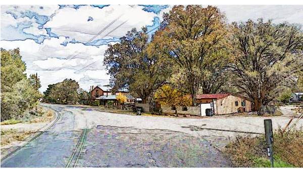
Camino Real and the Old 1926 Route 66 in Algodones
Name: New Mexico
The Spaniards named it in 1563 after the Aztec (Mexica) Empire. At that time, what is now known as Mexico was named Nueva España (New Spain), and only after 1821 did it become Mexico.
New Mexico's History
The Clovis culture with a distinct stone tool industry dates back to almost 13,000 years, and is named after the site in Clovis, NM. These Paleo-Indians would later lead to the Pueblo and Mongollon people met by the Europeans during their first forays into the region. Francisco Coronado explored the area in 1541 seeking the mythical wealthy city of Cibola.
The area was part of the Spanish Viceroyalty of New Spain, as the Province of New Mexico (1598). Spanish missionaries settled the Sangre de Cristo Mountains founding Santa Fe in 1608 and again after the 1680.1692 Pueblo Indian Revolt. Albuquerque was established in 1706. After Mexican independence, the province became part of Mexico (1821).
It was annexed by the US after the Mexican - American War (1846-48), established as a Territory in 1850 and enlarged by the Gadsden Purchase of 1853.
It was admitted in the Union in 1912, with its capital in Santa Fe.
Route 66 crosses the two prongs of the Rocky Mountains into New Mexico, the Sangre de Cristo Mountains east of Santa Fe, the Sandia Mountains east of Albuquerque and the Zuni Mountains west of Albuquerque. The Rio Grande River flows past Albuquerque. The eastern area is a high plateau that falls off towards the Texas Panhandle.
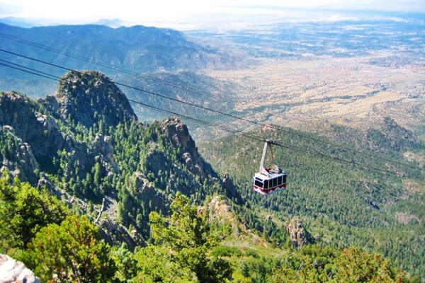
Sandia Crest Aerial Tramway
New Mexico, its Climate
Along the alignment of Route 66, in the higher parts of the State, summer temperatures are moderated by the altitude, averaging 70°F (26°C), but in other parts of the state, the temperature in July can exceed 100°F (38°C).
The state is arid or semi-arid and very dry: average rainfall is around 14 inches (350 mm) yearly.
It snows across the state in winter, especially in the higher northern mountains. Albuquerque averages around 2 inches of snow monthly in winter.
Bear in mind that altitude and dryness causes large swings between day and night temperatures, even in summer. Tornadoes are extremely unlikely in NM.
Cities in NM
Albuquerque is the largest city in the state (Pop. 556,495). Santa Fe is fourth with 69,976.
Around 492,000 people live along Route 66's corridor through New Mexico.
It has over 134,000 Native Americans and is an important center of Indian culture. The main groups are Navajo, Apache and Pueblo.
The Hispanic culture also permeates the state (half of its population has Hispanic origin) both from the original Spanish colonists and the later Mexican immigration. There is a strong presence of Native American art and handicrafts. Buy an Indian souvenir during your trip.
Where to Stay in New Mexico
Accommodation in New Mexico
The New Mexico towns along Route 66 offer different lodging options. Check out hotels and motels in the main towns.
Towns from East to West
- Motels and Hotels in Tucumcari .
- Motels and Hotels in Santa Rosa .
- Motels and Hotels in Moriarty .
- Motels and Hotels in Albuquerque .
- Motels and Hotels in Acoma Pueblo .
- Motels and Hotels in Grants .
- Motels and Hotels in Gallup .
Hotels along the Santa Fe segment of Route 66
- Motels and Hotels in Las Vegas NM .
- Motels and Hotels in Santa Fe .
> > Book your Hotels in New Mexico
Check out RV and Motorhome Parks & Campgrounds in New Mexico .
Map of Route 66 through New Mexico
Interactive route 66 map in new mexico.
Visit our New Mexico Route 66 map
It has the the location of each village, city and town linked to their webpages with full details on attractions, sights, Route 66 icons and more.
It also displays the different alignments of Route 66 across the state such as the 1926-37 one along the "Santa Fe Loop"
A map of New Mexico
Towns located on route 66.
Click on the links below for complete information on each town and village
Alphabetical list of Route 66 Towns in New Mexico
Albuquerque.
- Clines Corners
- Continental Divide
- Romeroville
- Santo Domingo
- Tucumcari part 2
Some activities and Tours in NM
Choose the town for full details....
Listed from East to West
Alphabetical list of Towns
Listed alphabetically
A list of New Mexico's Attractions
Below we list the main attractions along Route 66 in New Mexico. They are listed from east to west along the main alignment, followed by the Santa Fe Loop.
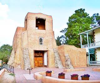
Oldest Church in the US San Miguel Mission, Santa Fe, A. Whittall
San Felipe de Neri (Albuquerque) Historic Site Saint Joseph Church (Laguna Pueblo) Historic Site San Esteban del Rey Mission Church (Acoma) Historic Site Santa Maria Mission (McCartys) Nuestra Senora de Guadalupe (Old Zuni) Mission (Zuni Pueblo) Historic Site Nuestra Señora de Dolores (Our Lady of Sorrows) (Tecolote) San Jose Church (San Jose) Mission Nuestra Señora de los Ángeles de Porciúncula de los Pecos (Pecos) Historic Site Nuestra Señora de Luz Church (Canoncito) Historic Site Cathedral Basilica of Saint Francis of Assisi (Santa Fe) Historic Site San Miguel Mission oldest church in the U.S. (Santa Fe) Historic Site Our Lady of Sorrows Church (San Lorenzo Sanctuary) (Bernalillo) Historic Site

Sands Motel Sign in Grants, A. Whittall
Blue Swallow Motel (Tucumcari) Historic Site Cactus Motor Lodge (Tucumcari) Historic Site Sunset Motel, Sands Motel, Cactus Motel and Lariat Motel (Moriarty) El Vado Auto Court Motel (Albuquerque) Historic Site De Anza Motor Lodge (Albuquerque) Historic Site Tewa Lodge (Albuquerque) Historic Site Luna Lodge (Albuquerque) Historic Site Wayside Motel and Sands Motel (Grants) Lariat Lodge (Gallup) El Rancho Hotel (Gallup) Historic Site Plaza Hotel (Las Vegas) Historic Site
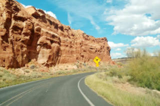
Dead Man's Curve, Mesita, A. Whittall
Other Historic Sites and Places to See
Odeon Theater (Tucumcari) Historic Site Kimo Theater (Albuquerque) Historic Site El Morro Theatre (Gallup)
General Stores and Trading Posts
Richardson Store (Montoya) General Store Historic Site Maisel's Indian Trading Post (Albuquerque) Historic Site Acoma Curio Shop (San Fidel) Historic Site Bowlin's Old Crater Trading Post (Bluewater) Historic Site Santo Domingo Trading Post (Santo Domingo) Historic Site

Santa Rosa Route 66 Museum, Tony Hisgett
Historic Districts
Park Lake Historic District (Santa Rosa) Historic Site Nob Hill District (Albuquerque) Historic Site Barelas-South Fourth Street Historic District (Albuquerque) Historic Site Old Colonial Town of Albuquerque (Albuquerque) Historic Site Barrio De Analco (Santa Fe) Historic Site
Rio Puerco Bridge (Suwanee) Historic Site Pecos River Bridge (San Jose)

Saint Joseph Church, Laguna Pueblo, A. Whittall
County Courthouse (Santa Rosa) Historic Site Greene Evans Garage (Moriarty) Historic Site Jones Motor Company (Albuquerque) Historic Site Nob Hill Shopping Center (Albuquerque) Historic Site Fort Wingate (Wingate) Historic Site Glorieta Pass Battlefield (Glorieta) Historic Site Oldest House in the U.S (Santa Fe) Historic Site Palace of the Governors (Santa Fe) Historic Site

Palomino Motel, Tucumcari Palomino Motel , Tucumcari, New Mexico, Ross Grif
Service Stations
Whiting Brothers Service Station (Moriarty) Ruins of the Whiting Bros. Gas Station (San Fidel) Roy T. Herman's Garage and Service Station (Thoreau) Historic Site Whiting Brothers Service Station and Motel (Continental Divide)
Historic Segments of Route 66
Each segment is Listed in the National Register of Historic Places
Glenrio to Tucumcari Tucumcari to Santa Rosa Albuquerque to Rio Puerco Laguna to McCartys McCartys to Grants Grants to Continental Divide Iyanbito to Rehoboth Manuelito to Arizona State Line
Ghost Towns

Bar in Suwanee, A. Whittall
Bard Endee Newkirk Cuervo Coolidge Perea Defiance Mentmore Twin Buttes Allison

Clines Corners Sign, Alan Levine
Other Landmarks
Club Cafe site (Santa Rosa) Route 66 Auto Museum (Santa rosa) Longhorn Ranch (Moriarty) Red Top Valentine Diner (Edgewood) Dead Man's Curve (Carnuel) Musical Highway (Carnuel) Valentine Diner Police Substation (Albuquerque) Owl Rock (Mesita) Dead Man's Curve (Mesita) The Continental Divide Watershed (Continental Divide)

Wayside Motel, Grants, A. Whittall
Kit Carson Cave (Church Rock) Biblical verse sign (Rehoboth) Forked Lightning Dude Ranch (Pecos) Santa Fe Trail Ending Place (Santa Fe)
Scenic Byways
The Turquoise Trail (Tijeras) Sandia Crest Scenic Byway (Tijeras) Salt Missions Scenic Byway (Tijeras)
Archaeological and Native American Sites
Tijeras Pueblo (Tijeras) Historic Site Sandia Cave (Tijeras) Historic Site

Ruins at Pecos Pueblo,
Laguna Pueblo Historic Site Acoma Pueblo (Acoma) Visit Zuni Pueblo (Zuni Pueblo) Rowe Pueblo Ruins (Rowe) Pecos National Historical Park (Pecos) Historic Site Pueblos close to Santa Fe (Santa Fe) Taos Pueblo (Taos) Historic Site Jemez Pueblo Kewa Pueblo (Santo Domingo) Historic Site San Felipe Pueblo (Algodones) Coronado Historic Site and Kuaua Ruins, (Bernalillo) Historic Site Sandia Pueblo Santa Ana Pueblo
Route 66 itinerary across New Mexico

Detailed description of the alignment of U.S. 66 through New Mexico, from East to West. For each town we give details of Route 66's alignment through it , so click above on a town and read more about the course of US 66 in that specific town.
California ¦ Arizona ¦ New Mexico ¦ Texas ¦ Oklahoma ¦ Kansas ¦ Missouri Illinois
Current mileage: 379 mi.
Above we detail each of the Historic Segments of Route 66 in New Mexico
New Mexico is the state with most mileage along Route 66. It is followed by Arizona with 388 mi.
At Albuquerque , two alignments of Route 66 cross each other, one went through Vegas and Santa Fe (the Santa Fe Loop ), the other (after 1938), bypassed them.
Route 66 crosses the state of New Mexico from Glenrio on the Texas border to Gallup in the high region in western NM. The old alignment runs mostly parallel to I-40.
A detailed description of Route 66's course across New Mexico with all the towns, attractions and landmarks.
From Glenrio , a Historic Site and Ghost Town, on the Texas state line, (mile zero), follow Route 66 westwards, it is a gravel surfaced road.
The road crosses San Jon River (7 miles) and heads west where it meets I-40 and becomes its South Service Road, (15 mi.). Enter the town of San Jon (18 miles) and follow Route 66 all the way to Exit 335 (38 mi.) as the Southern Frontage Road of I-40.
At the Exit, follow the road across I-40 into Tucumcari as I-40 Bus. Loop. - E. Tucumcari Blvd. (41 mi.)
Plenty of Attractions : See its Historic Blue Swallow Motel , to the north of the town is the Conchas Lake State Park .
Pass through the downtown (41 miles), and carry straight on until reaching US 58, where you take a left towards I-40 and get onto it, westwards at Exit 329 (44 miles).
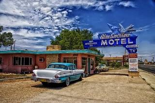
Blue Swallow Motel, New Mexico
The old Route 66 continues but is cut at different places (on the North of I-40, as W. Tucumcari Blvd. and later at mile 70, you can spot it as the South Frontage Road which is inaccessible at this point).
You can leave I-40 at Exit 321 and go to the South Service Road, heading west along it (52 mi.) it passes to the north side of the Interstate (56 mi.).
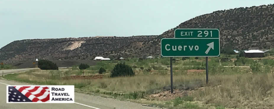
Go by Montoya (63 miles) with its Historic site: Richardson Store . The road keeps close to I-40 and reaches Newkirk (75 mi.), and keeps due west until it reaches Cuervo where it passes to the south side again (Exit 291 - 84 miles). Cross I-40 and turn right after the bridge.
The road forks, the right branch heads back to I-40 (Frontage road), take the left fork which adopts a SW course and separates from the Interstate. It will meet NM-156, (91 mi.) take a right along it.

Souvenir Shop in Tucumcari, NM.
Check out its Attractions : See its " Blue Hole ", and the Park Lake Historic District (Historic Place).
Leave town and head north (U.S. 84), cross to the North of I-40 at Exit 273, head West along the Interstate. At Exit 267 (119 miles), to the north, is NM 379, the original 1920s alignment via Santa Fe which was moved shortly after further west to what is now Exit 256 where NM 219 departs north to Santa Fe with US. 84, following the 1930s alignment which we describe below:
Click to keep on the 1937 alignment westwards
Route 66 through Santa Fe Route 66, the "Old" Santa Fe Loop This is the pre-1937 alignment, which curved north to Santa Fe, and then south back to Albuquerque. The later alignment cut straight west to Albuquerque. Leave I-40 and drive north towards Las Vegas along it, passing by Dilia , and reach I-25 at Romeroville (Exit 239), along I-25 to the east is Las Vegas: Las Vegas It has many Attractions , for instance, The Santa Fe Trail passed through this town. Visit its Las Vegas National Wildlife Refuge .
Return by I-25 to Romeoville and keep west along it. Take Exit 335 and follow the frontage road as it crosses back and forth across I-25. Pass Tecolote , and at Bernal take Hwy B26A on the south side and then back to the north side along the Frontage Road and, again, on the south at Pecos River .
The road courses along a forested mountainous region. Pass Ilfeld and Rowe . At Exit 307 go to the north side along NM-63, pass through Pecos and take NM-50 to leave the town.
At Glorieta use Exit 299 to return to I-25 West. At Exit 294, take the " Old Las Vegas Highway " NM-300, which is the Frontage Rd. and becomes NM-466 as it reaches Santa Fe .
Go right into the city center along Pecos Trail , leaving NM-466; merge with the " Old Santa Fe Trail ", and reach the downtown area.
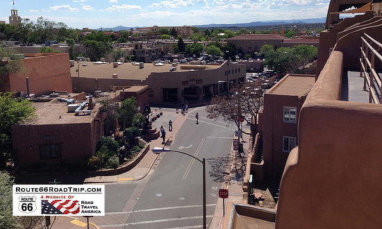
See all the Attractions & sights in Santa Fe . State Capital and ancient Spanish colonial town. Visit St. Francis Cathedral and the Palace of the Governors. Take in its typical building style.
Leave the center along Alameda St., Sandoval St. and then Cerrillos Rd. Cross US 84, keep SW, the road becomes NM-14. Get on I-25 at Exit 278.
At Exit 259 you can take a side trip to visit Santo Domingo with its Historic Places Santo Domingo Trading Post and Pueblo of Santo Domingo (Kewa Pueblo)
Leave I-25 at Exit 248 and take a right and then a left along Camino Real Pan American Central Hwy or NM-313, and follow it south through Algodones and Bernalillo all the way into Albuquerque.
At Sandia Pueblo it merges with NM-556 at a roundabout. Head west along NM556, it becomes 4th St. NW. At Lomas Blvd.
The old alignment enters Albuquerque along 4th St., which changes direction, so follow 5th until meeting the other (1937) alignment of US 66 from Santa Rosa via Moriarty, on Central Ave in the downtown district of Albuquerque.
Getting back to the post-1937 alignment:
The 1937 alignment west of Santa Rosa to Albuquerque
Stick to I-40 which runs straight west for 25 miles, where it turns to cross some low hills. It crosses US 285 (158 mi.) at Clines Corners .
Southwest, along U.S. 285, it is 158 miles to Roswell, of UFO fame .
Stay on I-40 west until Exit 197 (179 miles) to enter Moriarty along I-40 Bus. Loop, following old Route 66. Visit the Sunset Motel and Jr.'s Tire shop.
At 181 mi. Keep on this road until just before Exit 194, take a left and a right to follow NM-333 west, it runs south of I-40 towards the NW.
Go through Edgewood (189 mi.). At Montezuma Heights, hills will appear and you can take the 1930s-40s alignment, crossing to the north of I-40 (Exit 181 - 194 miles) and following Sedillo Hill Rd. (NM-306) which arches north, and then south, crossing I-40 again (198 miles). Enter I-40 at Exit 178 westbound.
At Exit 175, cross south again and take N-M-333 west, it is the Old US 66. Pass through Tijeras (202 mi.). In this area, US 66 crosses the Cibola National Forest and the Salt Missions Trail. The road crosses to the North of I-40 (225 mi.) goes through Carnuel and again to the south of I-40 running west into the outskirts of Albuquerque .
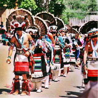
Pueblo people at Ohkay Owingeh. Carptrash
The road becomes (229 miles) Central Ave. NE, entering Albuquerque. The city has many Attractions and sites listed in the National Register of Historic Places: Luna Lodge, Tewa Motor Lodge, De Anza Motor Lodge, Nob Hill Shopping Center, Jones Motor Company, Pig and Calf Lunch, Cottage Bakery, Barelas-South Fourth Street Historic District, KiMo Theater, Maisel's Indian Trading Post, New Mexico Madonna of the Trail and El Vado Auto Court Motel .
Keep along Central Avenue, which crosses I-25 (217 mi.) to enter the oldest part of the city; it Becomes Central Ave NW, and on the corner of 47h St (219 miles) Route 66 crosses itself : it crosses the old 1920s alignment that came from Santa Fe. This is the " Old Town " of Albuquerque.
Follow Central Avenue as it curves around it and crosses the Rio Grande (221 mi.). The Avenue approaches I-40, but don't enter it, cross to its north side along Atrisco Vista Blvd. and follow the N. Frontage Road west at Exit 149. (228 miles), enter I-40 at Exit 140 (238 mi.) head West. Leave I-40 at Exit 126 (251 miles) and go south until meeting Old US Hwy 66 at Suwanee and follow it west.
Here at Suwanee, eastwards along NM-6 is the 1926-37 US66 alignment coming from Albuquerque through: Los Lunas , Peralta and Isleta .
The road adopts a NW course from this point, crosses to the north of I-40 (261 mi.) becoming Indian Service Rd 522 passing Mesita .
Keep along this Old Route 66 as it goes by Owl Rock , and the 180° Dead Man's Curve , and enters Laguna Pueblo .
Stop to see the old (1600s) church and the Historic Pueblo of Laguna , cross San Jose River (268 miles). Don't access I-40, stick to NM-124, pass through Paraje , the entrance to Cubero (277 miles), and reach San Fidel (281 mi.).
Stop by the Acoma Curio Shop , a Historic Site. Continue west and at Exit 96, NM-124 crosses to the south side of I-40, follow it west, take a detour south to visit McCartys . At mile 289, Anzac Rd. (dirt and gravel) forks to the left. This is the old 1920s alignment, you can drive it or keep on NM-124 and merge with Anzac Rd. further west, where NM-124 crosses to the North of I-40, follow it into Grants (296 mi.).
It has several Attractions , just to the north are the Casamero Anasazi ruins, and to the south, are the El Malpais National Monument, the La Ventana Natural Arch (NM 117) and the Cibola National Forest.
Next to Grants is Milan (302 miles). US 66 is now NM-122, and acts as the North Frontage Rd. of I-40. To the south is Bluewater with its Historic Bowlin's Old Crater Trading Post , followed by Prewitt and just off Route 66, Thoreau at Exit 53 of I-40 (329 mi.). See the Historical Site: Roy T. Herman's Garage and Service Station .
Stay west on NM-122 at Exit 47 you will reach the Continental Divide , at 7,245 ft. (2.209 m), the rainfall goes west to the Pacific or east to the Atlantic from this point. The 1930s alignment merges with I-40 here. Go west along the Interstate. Take Exit 36 towards the N. Frontage Rd. (346 miles) head west. To the south of Exit 33, at Wingate is the Historic District, Fort Wingate . Pass Church Rock (352 mi.) followed by Rehoboth ; cross to the SW of I-40 at Exit 26 (357 miles), entering Gallup .
Gallup Main Street
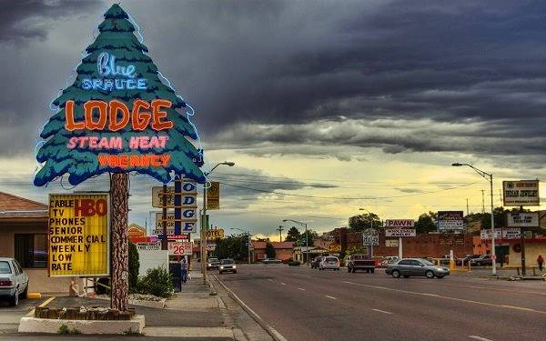
Gallup is mentioned in the song Route Sixty-six (Get your kicks...).
Check our page on Gallup, for its Attractions . Route 66 crosses the town, intersects its Main street (361 mi.) as Route 66 (I-40 Bus. Loop) , the town spreads south. Visit the Historic El Rancho Hotel , the Neon Art and El Morro Theater among other sights worth seeing.
At Exit 15, cross to the north of I-40 and stay on NM-118 west (366 miles), through Defiance , take a sharp right (368 mi.) to cross to the south of I-40 and continue west along NM-118. At Exit 8, US 66 crosses to the north side again, separates from I-40, Passing Manuelito at Surrender Canyon, and becoming its Service Road again (378 miles), and crossing the Arizona state Line to become Grant Rd. there. Mileage to this point (379 mi.) .
Accommodation Search box:
Some sponsored content:
>> Book your Hotel in Rolla
Banner image: Hackberry General Store, Hackberry, Arizona by Perla Eichenblat.
Social Media
Travel Route 66 Across New Mexico
We've had the opportunity to get out on the road and explore Route 66 all across New Mexico, the " Land of Enchantment ".
The segments across New Mexico on Route 66 totaled 487 miles at one point in time. Alignments varied over the years as the road was improved, and shortened. The road tended to follow the historic path of previous highways across the state, the 35th Parallel. New Mexico’s elevation along this route varies from a low of 3,800 feet at the Texas border to over 7,200 feet at the Continental Divide near Thoreau, creating a roadbed characterized by climbs, descents, switchbacks and cuts.
Route 66 passed through these cities, towns and villages, heading east to west, depending on the year and route alignment:
- Albuquerque
- Continental Divide
The original 1926 Route 66 alignment created a large "S Curve" as it headed north to near Las Vegas , then west to Santa Fe through Tecolate, Bernai, San Jose, Pecos and Glorieta Pass, and then back south to Albuquerque. In Santa Fe, Route 66 traveled along the Old Santa Fe Trail, passing the San Miguel Mission and Loretto Chapel and across the Santa Fe River to the historic LaFonda on the Plaza Hotel.
The 1926 alignment came into Albuquerque from Santa Fe on Highway 313, and ran through downtown north-to-south along 4th Street. Today the Barelas-South Fourth Street Historic District just south of downtown is a popular attraction, with shops, restaurants and other businesses.
Route 66 then continued south to Los Lunas, where it turned west to Laguna.
The 1926 alignment was replaced in 1937 with a more direct westward route into Albuquerque along Central Avenue, and then from Albuquerque directly to Laguna, and beyond to Gallup, following the current route of I-40 in many locales.
With realignments and road improvements, the distance of Route 66 in New Mexico was reduced to 399 miles by 1938, and Santa Fe was removed from the Mother Road.
Driving time today to travel the 280 miles from Amarillo to Santa Fe is about four hours via I-40 to Cline's Corners, and then north on U.S. 285. An alternate route is to take Exit 256 off I-40 onto U.S. 84 north after Santa Rosa; U.S. 84 then connects with I-25 to Santa Fe.

Interactive Map of Route 66 in New Mexico
Heading Westbound at the Texas-New Mexico Border: The Ghost Town of Glenrio
Sitting directly on the Texas - New Mexico border at Exit 0 is the abandoned ghost town of Glenrio . The townsite still has noticeable traces of Route 66 and the motels and restaurants that used to thrive there before the arrival of I-40. Just west of Glenrio, Route 66 bridges are still visible to the alert I-40 traveler.
Originally a railroad town, the village was renamed from Rock Island to Glenrio by the Rock Island and Pacific Railroad in 1908, and began receiving motorists driving the Ozark Trail in 1917. Its original structures were adobe buildings. The Rock Island Railroad depot closed in 1955, and the opening of Interstate 40 in 1975 further accelerated the demise of Glenrio.
The Glenrio Historic District encompasses the Route 66 roadbed and 17 abandoned structures. Remains can still be seen of an old motel, cafe, service station, the post office, and a few other buildings, as well as the old Route 66 roadbed. Some structures are posted, so in respect for owners and residents, please observe any "No Trespassing" signs.
Visitors today will notice construction underway in Glenrio. Parts of the area have been purchased and are slated for redevelopment. Read more:
- Business partners invest in abandoned town of Glenrio to revitalize the area (KFDA Amarillo)
- Glenrio Smoke Stop (in New Mexico)
For those traveling westbound, be sure to stop at the nicely designed and operated New Mexico Welcome Center . It is stocked well with maps and brochures about Route 66 and all of New Mexico; friendly staff members are always available to answer questions.
The old Route 66 then continued westward from Glenrio through San Jon, Tucumcari, Montoya, the ghost town of Cuervo and Santa Rosa.
Just Across the Border into New Mexico
Located on Historic Route 66, family-owned Russell's Truck & Travel Center offers a complete grocery store, an authentic Route 66 Diner, a classic car and memorabilia museum, a chapel, and great showers. It is located at 1583 Frontage Rd 4132, Glenrio, NM 88434. Take I-40 Exit 369 (Highway 392).
It was purchased in 2023 by Travel Centers of America (TA). Read more at the Russell's Travel Center website .
Tucumcari Travel Highlights
Leaving Glenrio, and back on I-40, we drive 42 miles and arrive at Tucumcari with its variety of vintage motels and electric neon signage.
For many years, Tucumcari has been a popular stop for cross-country travelers on Interstate 40 and previously Route 66. Numerous businesses, including gasoline service stations, restaurants and motels, were constructed to accommodate tourists as they traveled through on the Mother Road.
Today, Old U.S. Route 66 runs through the heart of Tucumcari via Route 66 Boulevard. A large number of the vintage motels and restaurants built in the 1930s, 1940s, and 1950s are still in business.
Tucumcari offers a variety of lodging options, and features over twenty motels for the traveling public, including the historic and well-known Blue Swallow Motel. Many "one-of-a-kind" properties are available as well as nationally operated chain facilities. Several are in the city, others offering great views of area lakes. Long famous for its number and variety of motels and lodging, the city adopted the " Tucumcari Tonite " advertising campaign.
And Tucumcari is known for its murals painted on area buildings; more than twenty have been painted thus far.
Tucumcari hotels and traveler reviews at TripAdvisor
Town of Cuervo
As we leave Tucumcari, we head west again, for 41 miles. Cuervo, New Mexico is an old Chicago, Rock Island and Gulf Railroad town that today is mostly abandoned, although some residents still live there.
The railroad siding was built in 1902 and named "Cuervo". The post office was opened that same year.
Most of the town is on the south side of I-40, between the interstate and the hills to the south. A variety of old buildings, houses and churches survive today. A ghost town? Not quite, but close!
A Stopover in Santa Rosa
Only 18 more miles and we arrive in Santa Rosa, located on the Pecos River.
When Route 66 passed through Santa Rosa in 1930, numerous service stations, cafés and motor courts were built to accommodate motorists traveling the Mother Road.
Driving down Santa Rosa’s Historic Route 66 today, travelers see many old signs and buildings … remnants of the days when the bright neon lights were a welcome sight to weary travelers looking for great food and comfortable lodging.
Santa Rosa still delivers that down-home, Main Street USA friendliness. It offers classic Route 66 cars and neon, the best in fishing, boating and water skiing, camping, and a place for a cool swim in the Blue Hole .
One of the popular local attractions is the Route 66 Auto Museum , which draws car buffs from all over the country and beyond. The museum houses a large collection of classics, low riders, muscle cars and motorcycles … plus, gas pumps and other auto memorabilia from the early days of Route 66.
The Santa Rosa Information Center can assist with maps, event information, recreation opportunities, dude ranches, rodeos, local southwest history, the geology of the world-famous Blue Hole and in locating Route 66 alignments and remnants of the road.
Santa Rosa offers a variety of hotels, inns, RV parks and campsites for visitors to the area.
Two Route 66 Alignments to Follow Leaving Santa Rosa
As one leaves Santa Rosa today heading west, there are two options to follow:
- The 1926 alignment through Santa Fe to Albuquerque
- The post-1937 alignment through Clines Corners and Moriarty to Albuquerque
Approximately 507 miles long in 1926, the alignment of Route 66 in New Mexico was reduced to 399 miles by 1938 bypassing Santa Fe.
The longest sections of the initial alignment created a large "S curve" as the road stretched across the middle of the state.
Arriving in Santa Fe on the 1926 Alignment
Once in Santa Fe , Route 66 passed through the heart of downtown, along side the historic LaFonda on the Plaza Hotel.
The Santa Fe Trail was a 19th-century transportation route through central North America that connected Independence, Missouri with Santa Fe. It served as a vital commercial highway until the introduction of the railroad to Santa Fe in 1880. Santa Fe was also near the end of the El Camino Real de Tierra Adentro which carried trade from Mexico City.
Santa Fe remained on the original Route 66 until 1938 when the road was rerouted on a more direct route thru Clines Corners to Albuquerque.
Today, Santa Fe is located on Interstate Highway 25, about 65 miles northeast of Albuquerque. U.S. Highway 285 traverses with city in a north-south orientation. Santa Fe is the capitol city of New Mexico, and is positioned at 7,000 feet above sea level.
Lodging Options in Santa Fe
More santa fe information.
Tourism Santa Fe - Official Travel Site New Mexico Tourism Official Website

Leaving Santa Fe Southbound on Route 66
In Santa Fe, Route 66 traveled along the Old Santa Fe Trail, passing the San Miguel Mission and Loretto Chapel and across the Santa Fe River to the historic LaFonda on the Plaza Hotel.
From there it turned west on Water Street, and then left onto Galisteo Street and Cerrillos Road southward towards Albuquerque as shown in the map above.
The old route then passed the School for the Deaf and lodging properties like the El Rey Inn. Outside of town Route 66 followed the course of the Camino Real.
Leaving Santa Fe, Route 66 was relatively flat, as it traversed the La Bajada Mesa.
Route 66 Down La Bajada Hill
About 15 miles to the south, Route 66 made the steep, 500-foot descent down the La Bajada precipice in only two miles via a series of 26 switchbacks with a 28% grade.
Remnants of the switchbacks and their scar on the earth can still be seen by hikers and those in high-clearance, 4-wheel drive vehicles, and from satellite photos like the one shown to the right.
In 1932 Route 66 was moved about three miles to the east near the current route of Interstate 25.
Read more about La Bajada Hill and El Camino Real at the NPS website .
The "Big Cut" on Route 66
South of La Bajada between Santa Fe and Albuquerque was the "Big Cut". Located near the present-day San Felipe Pueblo, this was an engineering marvel when it was completed in 1909 as part of New Mexico's Route 1. Route 66 passed through the notch from 1926 to 1931.
It consisted of a 75-foot long, 60-foot deep cut in Gravel Hill in the foothills of the Sandia Mountains made by hard working construction workers with dynamite, picks and shovels. The 18-foot wide roadway was no longer used when Route 66 was realigned in 1931.
Remnants of the cut can still be seen from southbound I-25 at Exit 252 in back of the casinos on the east side of the interstate.
Visiting Albuquerque, New Mexico
The original length of Route 66 in New Mexico in 1926 was about 507 miles. Funding for a straighter, shorter route was approved in 1931.
The 1926 Route 66 alignment came into Albuquerque from the north on Highway 313, and ran through downtown along 4th Street north-to-south. Today the Barelas-South Fourth Street Historic District just south of downtown is a popular attraction, with shops, restaurants and other businesses. Route 66 then continued south to Los Lunas, where it turned west to Laguna.
This alignment was replaced in 1937 with a more direct westward route from Albuquerque to Laguna, and beyond to Gallup, following the current route of I-40 in many locales.
The 1937 alignment also bypassed Santa Fe, coming in directly from the east into downtown Albuquerque, running west-to-east on Central Avenue.
Dozens of motels, cafes, gift shops and restaurants spring up along the route. Some of these vintage motels remain, and historic neon signs still glow on old Route 66 through Albuquerque.
Today, tourism is a big industry in Albuquerque, hosting events such as the International Balloon Fiesta.
It offers a variety of attractions such as the Sandia Peak Tramway, Indian Pueblo Cultural Center, National Museum of Nuclear History, San Felipe de Neri Church and Albuquerque Old Town.
Budville, New Mexico
Grants, new mexico.
The City of Grants is located in Cibola County, roughly half-way between present-day Albuquerque and Gallup on Interstate 40.
Grants offers visitors a wealth of historical and recreational activities. Several attractions are located in the city, such as the New Mexico Mining Museum and the Route 66 Vintage Museum & Double Six Gallery. Nearby is the La Ventana Arch in the El Malpais National Conservation Area.
The city sits at an elevation of 6,460', and is home to more than 9,000 residents.
A popular attraction today is the drive-thru neon Route 66 Arch , completed in 2016 and located off Exits 81 and 85. You park under the arch, and take "selfies" ... don't miss it!
Visiting Gallup, New Mexico
Gallup is the largest city between Albuquerque and Flagstaff, and has a population of about 22,000 residents. The city sits at an elevation of 6,512', and is known as the " most patriotic small town in America ".
It is located about 140 miles west of Albuquerque, and 185 miles east of Flagstaff, and only 23 miles from the Arizona-New Mexico border. The city is located in the middle of the Navajo Reservation.
Because of the nearby rugged terrain, it was a popular location in the 1940s and 1950s for Hollywood Westerns and has hosted many well-known movie stars such as John Wayne, Katharine Hepburn, Humphrey Bogart, Ronald Reagan and Kirk Douglas.
Restaurants such as the famous El Rancho reflect the western and Indian influences on the town.
Today’s visitors can partake in a meal at the El Rancho or enjoy an overnight stay and tour the memorabilia-lined grand lobby. Gallup has over 30 other hotels and over 90 restaurants and is a popular stopover point for those traveling Historic Route 66.
Area attractions include the Manuelito Visitor Center, the Navajo Code Talker Museum, the Gallup Cultural Center in the historic Santa Fe Railway depot, Red Rock Park & Museum, Bill Malone Trading Company and much more.
Shopping is also a big local attraction, with 110 trading posts, shops and galleries in Gallup, making the town the undisputed Southwestern center for authentic Native American art.
Lodging Options Along Route 66 from Santa Fe to Gallup
Clines corners.
The post-1937 Route 66 alignment cut about one hundred miles off the previous, 1926 alignment through Santa Fe. The road stretched west from Santa Rosa, and climbed over 2,400 feet by the time it arrived at Clines Corner.
Roy Cline opened his rest stop in 1934 at the intersection of what was then New Mexico State Highways 6 and 2. For decades since, travelers have stopped at Clines Corners Travel Center for a needed break, fuel, or just their homemade fudge. Today, Clines Corners Retail Center spans over 30,000 square feet.
It is located at the intersection of I-40 and U.S. 285, 68 miles east of Albuquerque, at Exit 218. It offers gasoline, a restaurant, souvenirs and gift shop, large clean restrooms, RV park, and more! It's always worth a stop. The official address is 1 Yacht Club Drive, Clines Corners, NM, 87070. Phone: 575.472.5488, or visit the Clines Corners website
From Clines Corners, Route 66 continued west, through Moriarty, Edgewood, Tijeras, and into Albuquerque.

Route 66 Sedillo Hill Travel Center
- Get a widget
- Report an error
14 photos Route 66 Sedillo Hill Travel Center
Reviews about route 66 sedillo hill travel center.
- Matthew B. September 18, 2022, 9:50 pm The help is great 0 0 Reply
- David K. September 3, 2022, 8:58 am The folks managing this store were so friendly and helpful. We walked in and were treated like old friends. Bought ice and one of their guys carried it out the car and even put it in the ice chest, service was amazing!! 0 0 Reply
- Rivetear July 8, 2022, 6:47 pm Very nice people 0 0 Reply
- Steven C. July 3, 2022, 11:39 pm Best Gas Station in the Southwest!!! Great Staff Especially Jessica My Credit Card was declined because my funds hadn't Hit my account and was delayed for what ever reason, JESSICA told me just to come back later and pay her then. So she took care of my Bill out of her pocket until I returned to pay her. This Never happens in this World we now live in. I'm a Customer for Life!!! Thanks Jessica your the Best 0 0 Reply
- Roger G. July 1, 2022, 8:13 pm This travel center has a decent selection of goods. 0 0 Reply
- Blake C. June 8, 2022, 9:11 pm Great spot to stop! 0 0 Reply
- Troy G. May 10, 2022, 6:39 pm Wonderful lil store with a bit of everything w/a Friendly happy staff making it a pleasant experience. 0 0 Reply
- Cyber N. April 23, 2022, 10:38 pm We are traveling across country back to South Dakota (bringing daughter back from college in AZ.) Driving through New Mexico and stopped at the Sedillo Hill Travel Center because my daughter was carsick and needed a bathroom. These people went above and beyond anything I could ever hope for! They brought my daughter crackers to the bathroom. They gave me cleaning supplies for the car, They even brought a treat for our dog when they saw her outside! Unbelievable! I am overwhelmed with their ki ndness. The world needs more people like this! Skip the big truck stops and visit Route 66 Sedillo Hill Travel Center!! … – show 0 0 Reply
- Charles C. April 23, 2022, 9:27 am Love this place! Sooooo clean! The staff are so nice! 0 0 Reply
- Alan R. April 13, 2022, 5:25 pm Open from 7am to 7pm, since hours ate not listed. The selection was AMAZING, like a kid in a candy store of snacks and drinks aplenty, not to mention the Awesome staff running the show. They were super friendly and helpful. Made my experience here one I will definitely repeat in the future. 0 0 Reply
- Gerald G. March 4, 2022, 10:21 pm These are some of the nicest people I have ever met!!! I had flat tire and was waiting for tire company to repair. I went in to the store and felt extremely welcome. Happy atmosphere for sure!!! Thanks for being so kind and friendly!!! 0 0 Reply
- Antonio A. January 19, 2022, 2:04 am Best gas station in the east mountains 0 0 Reply
- Karl W. November 1, 2021, 5:31 pm Nice clean store,friendly staff 0 0 Reply
- Brandy N. October 27, 2021, 10:36 pm Nice store 0 0 Reply
- Adam B. August 26, 2021, 3:56 am Every time I stop here I'm greeted by the friendliest people around. Every. Single. Time. The store is clean and has an excellent selection of everything you're looking for… plus fresh popcorn! 0 0 Reply
- Queen T. May 28, 2021, 4:58 am The service is always quick. 0 0 Reply
- Shawn S. April 16, 2021, 12:43 am The cleanest gas station I've ever been into, it looks really nice inside the store 0 0 Reply
- Dave T. February 4, 2021, 5:38 am Service was great and friendly. Restrooms where very clean. Good selection of products in the store. 0 0 Reply
- KSStorm I. November 26, 2020, 11:58 pm This is an interesting place. The cold drink coolers are in the wing with the rest rooms, which struck me as odd placement. The store is clean and staff is friendly. You can tell they have regulars, the customer in front of me was asked if he wanted to sign a card for someone it sounded like had been quite sick. 0 0 Reply
- rosemary s. October 26, 2020, 9:35 pm I work here. Awesome place. Friendly atmosphere. 0 0 Reply
- Vehicle Services in New Mexico
- Route 66 Sedillo Hill Travel Center
Gas stations in New Mexico
- Route 66 New Mexico 87059
- Cumbres Mercado Tijeras, NM 87059, 1192 NM-333
- Zuzax Gas Mart Tijeras, NM 87059, 844 NM-333
Edgewood , NM
Edgewood is a clean little town along I-40. There is an RV park with an old Red Top diner (not open for business) similar to the one at the Route 66 Museum in Clinton, Oklahoma. There is gas and there are plenty of places to eat. Edgewood has the Wild West Nature Park, which has mountain lions, coyotes and other interesting wildlife. For bikers, stop by Knucklehead's Motorcycle Center on the West end of town. The next town is Zuzax. You will be on Hwy 333 for part of the way, but then take a detour down Sedillo Hill Rd. This detour is a winding road through several residential neighborhoods. If you are in a hurry, you can stay on Hwy 333 and skip the detour, but you will be missing a nice ride, and who knows whether you will get the chance to be here again.
Alternate Westbound Route
Follow Hwy 333 out of Edgewood - At the top of a hill leading into Tijeras canyon, look for a right turn crossing I-40 onto Sedillo Hill Rd (if you reacr the Sedillo Hill Travel Center you have gone too far) - At the intersctio with Hwy 333 go right onto Zuzax.
Alternate Eastbound Route
Stay on Hwy 333 in Edgewood to a Stop sign at the Junction with I-40 - Go left then take an immediate right onto Bus 40 into Moriarty.
Click here to get my book free!
Click here to see our YouTube Channel

Find a Route 66 Town
Follow the main route, get directions.
Advertisement
Sedillo Hill Travel Center
- Your Privacy Choices
- Bahasa Indonesia
- Los Angeles
- Philadelphia
- San Francisco
- Washington, D.C.
- Great Britain
- Netherlands
- Philippines
Foursquare © 2024 Lovingly made in NYC, CHI, SEA & LA
People tend to check in during these times:
- 1:00 PM–6:00 PM
- 10:00 AM–7:00 PM
- 11:00 AM–7:00 PM
- 8:00 AM–6:00 PM
- 10:00 AM–4:00 PM
Is this your business? Claim it now.
Make sure your information is up to date. Plus use our free tools to find new customers.
You must enable JavaScript to use foursquare.com
We use the latest and greatest technology available to provide the best possible web experience. Please enable JavaScript in your browser settings to continue.
Download Foursquare for your smart phone and start exploring the world around you!
Visit Albuquerque prohibits users from downloading images from our website.

Route 66 Travel Center
- I-40 Exit 140, Albuquerque, NM 87121
- Phone: (505) 352-7866
- Phone Toll-free: (866) 711-7829
- Visit Website

- Days Open: Daily
- Hours of Operation: 24 hours
- Miles to Airport: 25

Find out the latest and greatest that Albuquerque has to offer. More
Coupons & Discounts
Save money on Albuquerque and New Mexico restaurants, shopping, hotels, attractions, theater and more. Create... More
Consistently ranked in AmericanStyle Magazine's Top 25 Arts Destinations in the... More
Sports & Outdoor
The city of Albuquerque sits at a mile above sea level (5,000-6,000 ft. elevation) and has a high-desert... More

Family Fun & Games
Albuquerque has fun for all ages, see our family fun page to learn more! More
Route 66 Sedillo Hill Travel Center
New Mexico, New Mexico 87059, USA
City : New Mexico
State : New Mexico
Zip Code : 87059
Average Ratings : ⭐ 4.9
Latitude : 35.100421
Longitude : -106.2877021
Opening Hours
10AM-6:30PM
Navigate to Route 66 Sedillo Hill Travel Center, New Mexico, New Mexico 87059
Below are the driving Directions to Route 66 Sedillo Hill Travel Center in New Mexico, New Mexico 87059, United States .
Route 66 Sedillo Hill Travel Center is one of the Nearest Gas Station in the Area that is conveniently Located on the New Mexico (Street) of New Mexico (City) at 35.100421 latitude and -106.2877021 longitude has a overall Rating of 4.9 in the 87059 zip code. Route 66 Sedillo Hill Travel Center in New Mexico road has been providing High quality Fuel and Services for its Customers. Route 66 Sedillo Hill Travel Center at New Mexico lane is known for its friendly Customer Service and Cleanliness.
Find Me Gas Pumps Near My Location
If you have any issues or queries with the Route 66 Sedillo Hill Travel Center Gas Station , New Mexico branch located in New Mexico ( NM ), contact the respected Gas Stations customer service at their phone number.
Categories - Gas Station
Gas Station In New Mexico, NM
Phillips 66
Gas Stations » Route 66 Sedillo Hill Travel Center in New Mexico, New Mexico 87059
Gas Station in 87059
Route 66 Travel Center

People also searched for
Liquor Store
Convenience Stores 24 Hours
Location & Hours
Suggest an edit
1184 NM-333
Tijeras, NM 87059
You Might Also Consider

Budget Transmission Masters
in Transmission Repair

Speedy Glass
in Auto Glass Services, Windshield Installation & Repair
Ask the Community
Ask a question
Yelp users haven’t asked any questions yet about Route 66 Travel Center .
Recommended Reviews
- 1 star rating Not good
- 2 star rating Could’ve been better
- 3 star rating OK
- 4 star rating Good
- 5 star rating Great
Select your rating
Overall rating

Clean bathrooms, super friendly staff, lots of snacks. It was in such an easy location for a quick off and back on the freeway. They even had a handmade jewelry vendor out front. Nice stop. The ladies working in there were the best!

NOT A TRAVEL CENTER as you would normally think of one. Parking lot so small I almost got stuck with my trailer. Couldn't even get gas because there was no way to drive around with a trailer.
Well-run place. Most everyone behind the counter is very friendly, and the place is well-staffed. Best place around for variety of liquor options.

Clean well appointed restrooms, friendly staff, good selection of eats and drinks. We had to detour around an accident on 40 East, so really had to pee, this was the first place available. Looks a little sketchy with gravel parking and Jenky Phillips 66 Hill travel Center sign, but it was great.

Out of the way place. Nice little area off the highway. Has a little of everything. Even wine and beer. Staff is not friendly but they do take care of you.

It says open 24 hrs and theyre closed at 6 Pm even their pumps how ridiculous is that?
The name Travel Center is deceiving in this case because it's not a big place in any capacity and had a bit of an eerie vibe to it. We bought gas but didn't fill up so we could move on.

JERRY!!! He has a great attitude in there makes you want to buy more stuff just by looking Adam because he's so friendly. We came in there to get some water my father and I and couldn't help but want to Peru's the isles because of Jerry's Knowledge of his store. Keep up the good work Jerry!
Stopped to fill tank while driving through the area. Employee turned off pump while I was pumping gas because it was quitting time. I only got 8 gallons. Went some where else to continue.
HAS DESIEL. great place nice inside hade everything i could ask for and the people were super nice and friendly great place all around

Quik Check Emissions, a DEKRA Company
in Smog Check Stations, Registration Services

in Auto Detailing, Windshield Installation & Repair, Auto Glass Services
Best of Tijeras
Things to do in Tijeras
People found Route 66 Travel Center by searching for…
Convenience Stores Tijeras
Browse Nearby
Convenience Stores
Restaurants
Other Gas Stations Nearby
Find more Gas Stations near Route 66 Travel Center
Related Cost Guides
Car Window Tinting
Gas Stations
Mobile Dent Repair
Registration Services
Smog Check Stations
Vehicle Shipping
People Also Viewed

Lisa’s Truck Centers

Warrior Fuel 2 Station

Murphy Express

Maverik Adventure’s First Stop

Shell Gas Station

Paradise Liquors

Brewer Oil Company

- passport login

Sedillo Hill Route 66 Travel Center Celebrates The Installation of a New Solar Power System

During a ceremony this morning, USDA Rural Development State Director Terry Brunner presented Fred Rael, the owner of the Sedillo Hill Route 66 Travel Center, with a certificate of completion for the installation of a new solar photovoltaic system.
USDA Rural Development provided a grant for twenty-five percent of the cost to install the solar power array. This financing was made through USDA Rural Development’s Rural Energy for America Program (REAP) program. Congress created the REAP program to help farmers, ranchers and small rural businesses access loan guarantees and grant funds to purchase renewable energy systems and to make energy efficiency improvements. The REAP program is only available in communities of less than 50-thousand people and is not available for residential use
During the presentation, Brunner said, “In the last couple of years we’ve seen more and more businesses use the REAP program to install a renewable energy systems.” He added, “We see businesses use the savings from energy efficiency upgrades to invest in other aspects of their operations.”
The Sedillo Hill Route 66 Travel Center received a $41,720 REAP grant to offset the cost of the installation of the new $166,878 solar power system. The system generates 80,504 kilowatt hours (kWh) of electricity which is enough to pay for 67% of the electricity needed to run the store. This much electricity could provide enough power to run seven households annually.
For those rural businesses, ranching and farming operations interested in accessing information on the REAP program visit USDA’s new energy website at: www.usda.gov/energy or call the Rural Development State Office in Albuquerque at 505-761-4957 .
Information from USDA

IMAGES
VIDEO
COMMENTS
View along the Sedillo Hill Road at its highest point. The 1937 Route 66 in Tijeras: Sedillo Hill Road in the Mountains, New Mexico. Click for St. view. This alignment meets the later one further west. The 1949 alignment runs on the south side of the freeway. Head west from exit 181 along NM-333, pass by Comer's Coffee shop and descend into ...
Sedillo Hill Travel Center Route 66 (505) 286-2647. More. Directions Advertisement. 1192 333 Tijeras, NM 87059 Hours (505) 286-2647 Sedillo Hill Travel Center Route 66 in Tijeras, NM, offers a range of services for travelers passing through the area. From fueling up at the gas station to grabbing a quick snack at the convenience store, visitors ...
1192 E Old Hwy 66 Tijeras, NM 87059. 66 people like this. 66 people follow this
Sedillo Hill Route 66 Travel Center located at 1192 U.S. Rt. 66, Tijeras, NM 87059 - reviews, ratings, hours, phone number, directions, and more.
Route 66 Travel Center Sedillo Hill. Route 66 Travel Center Sedillo Hill is a gas station in Bernalillo, New Mexico located on NM 333. Route 66 Travel Center Sedillo Hill is situated close to Bernalillo County Fire Station 43 (Montezuma Heights) and Sedillo Cemetery. Ukraine is facing shortages in its brave fight to survive.
Reaching them in Sedillo Hill. Here there are several alignments to cross it and enter Tijeras Canyon on the western side of the divide. >> green line in our custom map is US66 west of Edgewood. View along the Sedillo Hill Road at its highest point. The 1937 Route 66 in Tijeras: Sedillo Hill Road in the Mountains, New Mexico. Click for St. view
Plan your Road Trip along Route 66 in New Mexico; towns, parks, things to do, sights, attractions historic places and landmarks, places to visit. ... 194 miles) and following Sedillo Hill Rd. (NM-306) which arches north, and then south, crossing I-40 again (198 miles). Enter I-40 at Exit 178 westbound. At Exit 175, cross south again and take N ...
Just Across the Border into New Mexico. Located on Historic Route 66, family-owned Russell's Truck & Travel Center offers a complete grocery store, an authentic Route 66 Diner, a classic car and memorabilia museum, a chapel, and great showers. It is located at 1583 Frontage Rd 4132, Glenrio, NM 88434. Take I-40 Exit 369 (Highway 392).
Route 66 Sedillo Hill Travel Center details with ⭐ 22 reviews, 📍 location on map. Find similar vehicle services in New Mexico on Nicelocal.
Sedillo Hill Route 66 Travel Center is a charming gas station located at 1192 U.S. Route 66 in Tijeras, New Mexico. This iconic stop along the historic Route 66 offers travelers a convenient place to refuel and refresh during their journey. With friendly service, clean facilities, and a selection of snacks and beverages, Sedillo Hill Route 66 ...
Edgewood. , NM. October 16, 2023. Edgewood is a clean little town along I-40. There is an RV park with an old Red Top diner (not open for business) similar to the one at the Route 66 Museum in Clinton, Oklahoma. There is gas and there are plenty of places to eat. Edgewood has the Wild West Nature Park, which has mountain lions, coyotes and ...
1184 Nm-333. Tijeras, NM 87059. Route 66 Travel Center in Tijeras, NM, serves as a convenient stop for travelers passing through the area. Offering a range of amenities and services, this establishment caters to the needs of those on the road. Generated from their business information.
Continue on NM-333 (Historic Route 66). Barton. Continue on NM-333 (Historic Route 66). Sedillo. Alternative: An older than the final alignment is going north for a loop here: Turn right onto Sedillo Hill Rd. Cross I-40 at exit 181. Continue right on Sedillo Hill Rd. for about 3.5 miles. Cross I-40 to the south. Turn right onto NM-333. Continue ...
Timothy Roller May 9, 2012. Clean bathrooms and booze! Upvote Downvote. MacyandJewel December 24, 2011. Slowest fuel pumps ever! Upvote Downvote. See 11 photos and 3 tips from 224 visitors to Sedillo Hill Travel Center. "Fix the pot holes".
OTHER PLACES NEAR SEDILLO HILL TRAVEL CENTER - ROUTE 66. RG-22111 Water Well 1.35 0.02 Miles Away; Exit 181/Sedillo/E 1.35 I-40 0.14 Miles Away; Bernalillo County Fire Station 43 1.35 0.32 Miles Away; JJ cholla creations 1.35 309 Sedillo Hill Rd 0.35 Miles Away; Caitlyn Trucking LLC 1.35 PO Box 1265 0.50 Miles Away;
1 NM-344Edgewood, NM. $3.39. wh_bonney 3 hours ago. Details. Route 66 Travel Center in Tijeras, NM. Carries Regular, Midgrade, Premium, Diesel. Has C-Store, Pay At Pump, Restrooms, Payphone, ATM. Check current gas prices and read customer reviews. Rated 3.5 out of 5 stars.
Route 66 Travel Center. I-40 Exit 140, Albuquerque, NM 87121. Phone: (505) 352-7866. Phone Toll-free: (866) 711-7829. Visit Website.
Route 66 Sedillo Hill Travel Center is one of the Nearest Gas Station in the Area that is conveniently Located on the New Mexico (Street) of New Mexico (City) at 35.100421 latitude and -106.2877021 longitude has a overall Rating of 4.9 in the 87059 zip code. Route 66 Sedillo Hill Travel Center in New Mexico road has been providing High quality Fuel and Services for its Customers.
Clean well appointed restrooms, friendly staff, good selection of eats and drinks. We had to detour around an accident on 40 East, so really had to pee, this was the first place available. Looks a little sketchy with gravel parking and Jenky Phillips 66 Hill travel Center sign, but it was great.
Sedillo Hill Travel Center Route 66. 1192 State Route 333; Tijeras, NM 87059 (505) 286-2647 Get Directions Similar Businesses. PUEBLO LATINO LLC . Santa Fe, NM (505) 629-5263 View. Pueblo Latino Gas . Santa Fe, NM (505) 372-7109 View. Pueblo Latino Gas ...
Sedillo Hill Travel Center - Route 66. 1192 E Old Hwy 66, Tijeras, NM 87059. Sedillo Hill Travel Center - Route 66 is one of the popular Gas Station located in 1192 E Old Hwy 66 ,Tijeras listed under Automotive in Tijeras , Local business in Tijeras , Travel & Transportation in Tijeras , Add Review.
Find 86 listings related to Sedillo Hill Travel Center in Tijeras on YP.com. See reviews, photos, directions, phone numbers and more for Sedillo Hill Travel Center locations in Tijeras, NM. ... Route 66 Travel Center. Travel Agencies Truck Stops Gas Stations. Website. 36 Years. in Business. Amenities: Wheelchair accessible (505) 352-7876. 14314 ...
The Sedillo Hill Route 66 Travel Center received a $41,720 REAP grant to offset the cost of the installation of the new $166,878 solar power system. The system generates 80,504 kilowatt hours (kWh) of electricity which is enough to pay for 67% of the electricity needed to run the store. This much electricity could provide enough power to run ...
During a ceremony this morning, USDA Rural Development State Director Terry Brunner presented Fred Rael, the owner of the Sedillo Hill Route 66 Travel… Search Query Show Search passport login